You are here: Home > Network List > US - United States National Seismic Network Stations List
> Station WMOK Wichita Mountains, Oklahoma, USA > Earthquake Result Viewer
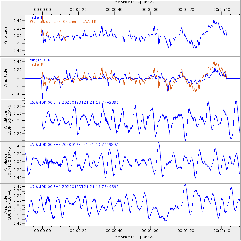
WMOK Wichita Mountains, Oklahoma, USA - Earthquake Result Viewer
*The percent match for this event was below the threshold and hence no stack was calculated.
| Earthquake location: |
Santiago Del Estero Prov., Arg. |
| Earthquake latitude/longitude: |
-27.0/-63.4 |
| Earthquake time(UTC): |
2020/01/23 (023) 21:11:28 GMT |
| Earthquake Depth: |
554 km |
| Earthquake Magnitude: |
5.5 Mww |
| Earthquake Catalog/Contributor: |
NEIC PDE/us |
|
| Network: |
US United States National Seismic Network |
| Station: |
WMOK Wichita Mountains, Oklahoma, USA |
| Lat/Lon: |
34.74 N/98.78 W |
| Elevation: |
486 m |
|
| Distance: |
70.0 deg |
| Az: |
329.456 deg |
| Baz: |
146.589 deg |
| Ray Param: |
$rayparam |
*The percent match for this event was below the threshold and hence was not used in the summary stack. |
|
| Radial Match: |
35.635242 % |
| Radial Bump: |
400 |
| Transverse Match: |
58.491783 % |
| Transverse Bump: |
400 |
| SOD ConfigId: |
20465011 |
| Insert Time: |
2020-02-06 21:25:07.864 +0000 |
| GWidth: |
2.5 |
| Max Bumps: |
400 |
| Tol: |
0.001 |
|
Signal To Noise
| Channel | StoN | STA | LTA |
| US:WMOK:00:BHZ:20200123T21:21:13.774989Z | 0.48902142 | 6.390255E-8 | 1.3067432E-7 |
| US:WMOK:00:BH1:20200123T21:21:13.774989Z | 0.91938734 | 1.2608106E-7 | 1.3713597E-7 |
| US:WMOK:00:BH2:20200123T21:21:13.774989Z | 1.1742071 | 9.871575E-8 | 8.407014E-8 |
| Arrivals |
| Ps | |
| PpPs | |
| PsPs/PpSs | |


