You are here: Home > Network List > G - GEOSCOPE Stations List
> Station MBO M'Bour, Senegal > Earthquake Result Viewer
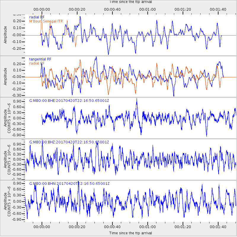
MBO M'Bour, Senegal - Earthquake Result Viewer
*The percent match for this event was below the threshold and hence no stack was calculated.
| Earthquake location: |
Southeast Of Easter Island |
| Earthquake latitude/longitude: |
-36.3/-98.4 |
| Earthquake time(UTC): |
2017/04/20 (110) 22:04:14 GMT |
| Earthquake Depth: |
10 km |
| Earthquake Magnitude: |
5.5 Mwb |
| Earthquake Catalog/Contributor: |
NEIC PDE/us |
|
| Network: |
G GEOSCOPE |
| Station: |
MBO M'Bour, Senegal |
| Lat/Lon: |
14.39 N/16.95 W |
| Elevation: |
3.0 m |
|
| Distance: |
91.7 deg |
| Az: |
73.467 deg |
| Baz: |
233.045 deg |
| Ray Param: |
$rayparam |
*The percent match for this event was below the threshold and hence was not used in the summary stack. |
|
| Radial Match: |
58.90195 % |
| Radial Bump: |
400 |
| Transverse Match: |
49.881073 % |
| Transverse Bump: |
400 |
| SOD ConfigId: |
2028011 |
| Insert Time: |
2017-05-04 22:05:31.101 +0000 |
| GWidth: |
2.5 |
| Max Bumps: |
400 |
| Tol: |
0.001 |
|
Signal To Noise
| Channel | StoN | STA | LTA |
| G:MBO:00:BHZ:20170420T22:16:50.65001Z | 1.0930673 | 3.7420475E-7 | 3.4234375E-7 |
| G:MBO:00:BHN:20170420T22:16:50.65001Z | 1.0558994 | 3.7132952E-7 | 3.516713E-7 |
| G:MBO:00:BHE:20170420T22:16:50.65001Z | 1.07049 | 2.7745483E-7 | 2.591849E-7 |
| Arrivals |
| Ps | |
| PpPs | |
| PsPs/PpSs | |


