TRI Trieste, Italy - Earthquake Result Viewer
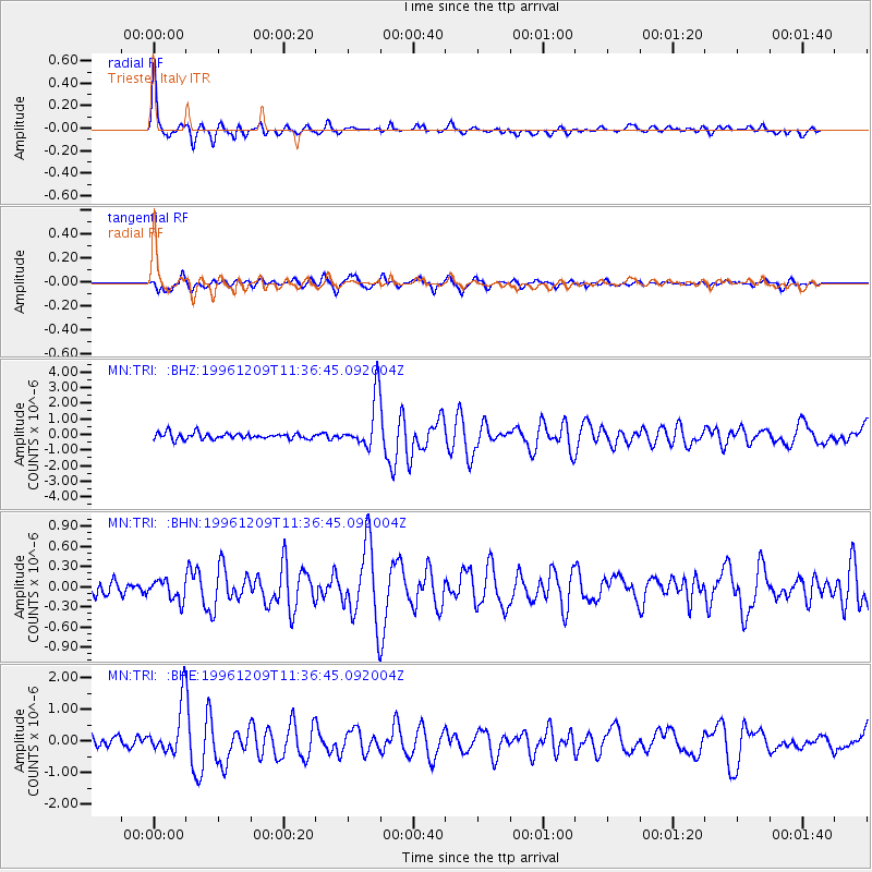
Earthquake location: Northern Mid-Atlantic Ridge
Earthquake latitude/longitude: 29.9/-42.9
Earthquake time(UTC): 1996/12/09 (344) 11:28:48 GMT
Earthquake Depth: 10 km
Earthquake Magnitude: 5.9 MB, 6.1 MS, 6.0 UNKNOWN, 5.9 MW
Earthquake Catalog/Contributor: WHDF/NEIC
Network: MN MEDNET Project
Station: TRI Trieste, Italy
Lat/Lon: 45.71 N/13.76 E
Elevation: 161 m
Distance: 46.5 deg
Az: 53.757 deg
Baz: 270.471 deg
Ray Param: 0.07060073
Estimated Moho Depth: 22.0 km
Estimated Crust Vp/Vs: 2.06
Assumed Crust Vp: 6.207 km/s
Estimated Crust Vs: 3.017 km/s
Estimated Crust Poisson's Ratio: 0.35
Radial Match: 87.82254 %
Radial Bump: 400
Transverse Match: 82.19252 %
Transverse Bump: 400
SOD ConfigId: 6273
Insert Time: 2010-03-08 17:29:20.999 +0000
GWidth: 2.5
Max Bumps: 400
Tol: 0.001

Signal To Noise

ChannelStoNSTALTA
MN:TRI: :BHN:19961209T11:36:45.092004Z1.06472151.498755E-71.40765E-7
MN:TRI: :BHE:19961209T11:36:45.092004Z5.04689078.217186E-71.6281679E-7
MN:TRI: :BHZ:19961209T11:36:45.092004Z8.3524451.6586137E-61.9857822E-7
Arrivals
Ps3.9 SECOND
PpPs10 SECOND
PsPs/PpSs14 SECOND