You are here: Home > Network List > TA - USArray Transportable Network (new EarthScope stations) Stations List
> Station L15K Ungalak Mountain, AK, USA > Earthquake Result Viewer
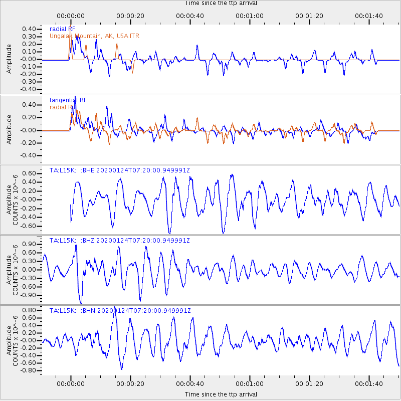
L15K Ungalak Mountain, AK, USA - Earthquake Result Viewer
*The percent match for this event was below the threshold and hence no stack was calculated.
| Earthquake location: |
Tajikistan |
| Earthquake latitude/longitude: |
39.1/71.5 |
| Earthquake time(UTC): |
2020/01/24 (024) 07:09:15 GMT |
| Earthquake Depth: |
10 km |
| Earthquake Magnitude: |
5.5 Mww |
| Earthquake Catalog/Contributor: |
NEIC PDE/us |
|
| Network: |
TA USArray Transportable Network (new EarthScope stations) |
| Station: |
L15K Ungalak Mountain, AK, USA |
| Lat/Lon: |
61.68 N/161.49 W |
| Elevation: |
219 m |
|
| Distance: |
70.8 deg |
| Az: |
23.791 deg |
| Baz: |
318.865 deg |
| Ray Param: |
$rayparam |
*The percent match for this event was below the threshold and hence was not used in the summary stack. |
|
| Radial Match: |
45.168404 % |
| Radial Bump: |
289 |
| Transverse Match: |
50.963863 % |
| Transverse Bump: |
277 |
| SOD ConfigId: |
20465011 |
| Insert Time: |
2020-02-07 07:21:47.871 +0000 |
| GWidth: |
2.5 |
| Max Bumps: |
400 |
| Tol: |
0.001 |
|
Signal To Noise
| Channel | StoN | STA | LTA |
| TA:L15K: :BHZ:20200124T07:20:00.949991Z | 2.8372753 | 6.0617333E-7 | 2.1364627E-7 |
| TA:L15K: :BHN:20200124T07:20:00.949991Z | 0.49877068 | 1.5453588E-7 | 3.0983352E-7 |
| TA:L15K: :BHE:20200124T07:20:00.949991Z | 1.5816305 | 4.0870376E-7 | 2.584066E-7 |
| Arrivals |
| Ps | |
| PpPs | |
| PsPs/PpSs | |


