
TRI Trieste, Italy - Earthquake Result Viewer
| ||||||||||||||||||
| ||||||||||||||||||
| ||||||||||||||||||
|
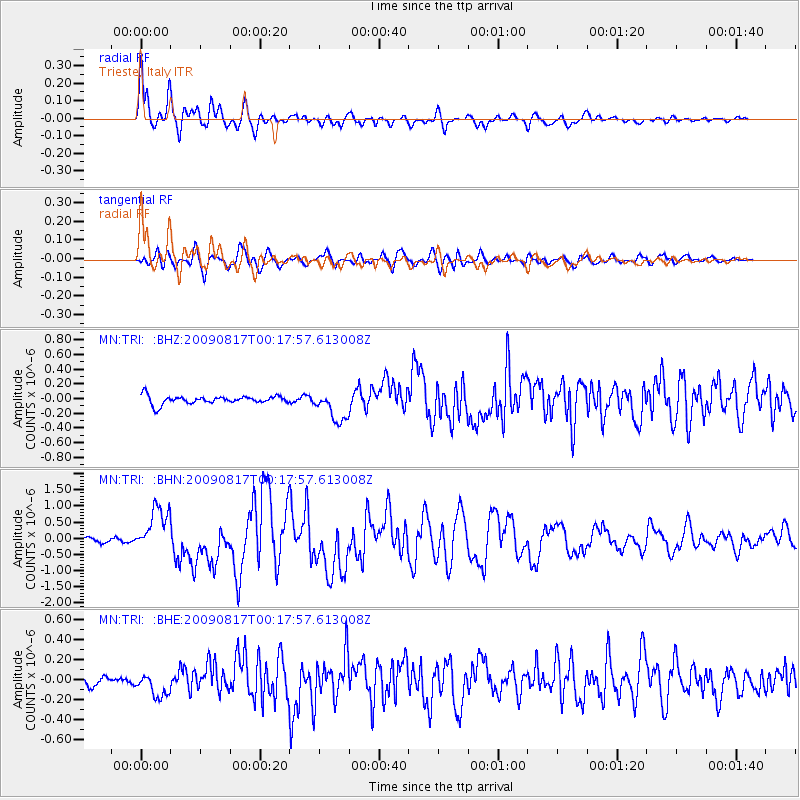
Signal To Noise
| Channel | StoN | STA | LTA |
| MN:TRI: :BHN:20090817T00:17:57.613008Z | 8.769867 | 7.054447E-7 | 8.043962E-8 |
| MN:TRI: :BHE:20090817T00:17:57.613008Z | 2.1874874 | 1.2400749E-7 | 5.6689466E-8 |
| MN:TRI: :BHZ:20090817T00:17:57.613008Z | 3.7409916 | 2.0904353E-7 | 5.5879177E-8 |
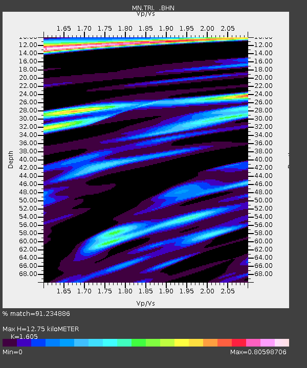
| Arrivals | |
| Ps | 1.3 SECOND |
| PpPs | 5.2 SECOND |
| PsPs/PpSs | 6.5 SECOND |

