You are here: Home > Network List > UU - University of Utah Regional Network Stations List
> Station FOR4 Blundell West, UT, USA > Earthquake Result Viewer
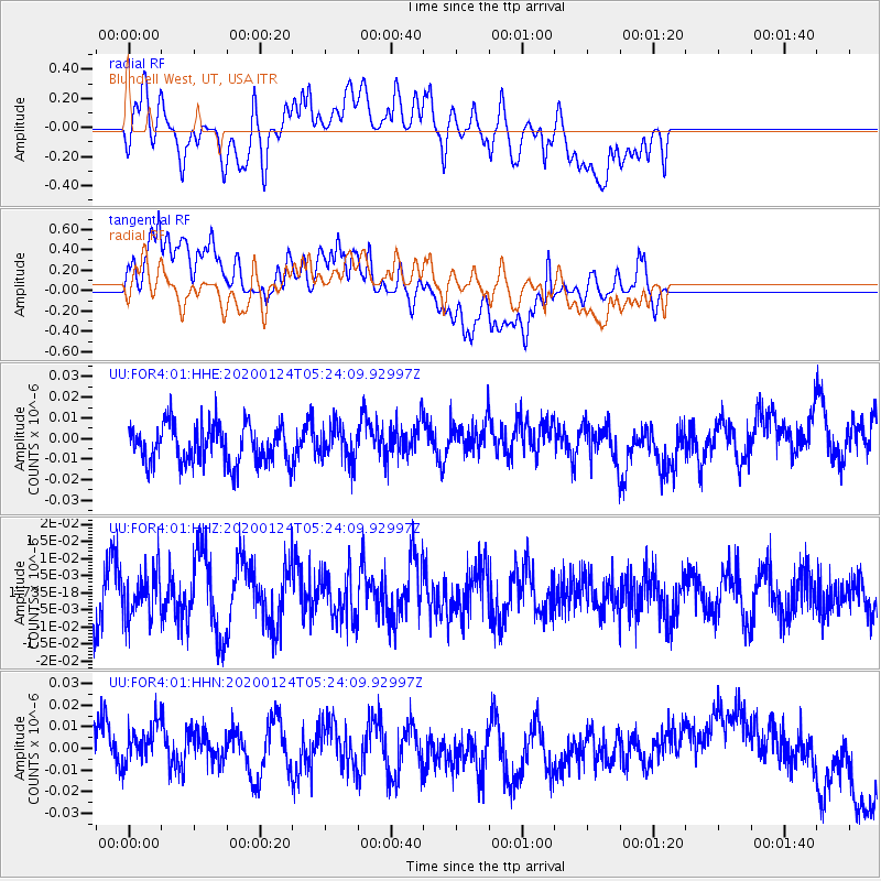
FOR4 Blundell West, UT, USA - Earthquake Result Viewer
*The percent match for this event was below the threshold and hence no stack was calculated.
| Earthquake location: |
Near Coast Of Peru |
| Earthquake latitude/longitude: |
-17.4/-71.0 |
| Earthquake time(UTC): |
2020/01/24 (024) 05:13:49 GMT |
| Earthquake Depth: |
75 km |
| Earthquake Magnitude: |
5.4 Mww |
| Earthquake Catalog/Contributor: |
NEIC PDE/us |
|
| Network: |
UU University of Utah Regional Network |
| Station: |
FOR4 Blundell West, UT, USA |
| Lat/Lon: |
38.50 N/112.90 W |
| Elevation: |
1657 m |
|
| Distance: |
68.0 deg |
| Az: |
325.617 deg |
| Baz: |
136.585 deg |
| Ray Param: |
$rayparam |
*The percent match for this event was below the threshold and hence was not used in the summary stack. |
|
| Radial Match: |
55.83181 % |
| Radial Bump: |
400 |
| Transverse Match: |
40.110638 % |
| Transverse Bump: |
400 |
| SOD ConfigId: |
20465011 |
| Insert Time: |
2020-02-08 12:38:40.537 +0000 |
| GWidth: |
2.5 |
| Max Bumps: |
400 |
| Tol: |
0.001 |
|
Signal To Noise
| Channel | StoN | STA | LTA |
| UU:FOR4:01:HHZ:20200124T05:24:09.92997Z | 0.85751355 | 6.750628E-9 | 7.872328E-9 |
| UU:FOR4:01:HHN:20200124T05:24:09.92997Z | 1.3224052 | 1.2255805E-8 | 9.267813E-9 |
| UU:FOR4:01:HHE:20200124T05:24:09.92997Z | 0.9077213 | 8.522406E-9 | 9.388792E-9 |
| Arrivals |
| Ps | |
| PpPs | |
| PsPs/PpSs | |


