You are here: Home > Network List > G - GEOSCOPE Stations List
> Station INU Inuyama, Japan > Earthquake Result Viewer
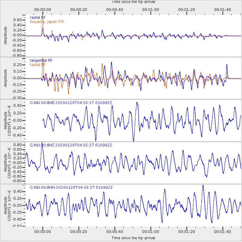
INU Inuyama, Japan - Earthquake Result Viewer
*The percent match for this event was below the threshold and hence no stack was calculated.
| Earthquake location: |
Andreanof Islands, Aleutian Is. |
| Earthquake latitude/longitude: |
51.0/-179.9 |
| Earthquake time(UTC): |
2020/01/26 (026) 03:57:19 GMT |
| Earthquake Depth: |
4.0 km |
| Earthquake Magnitude: |
5.7 Mi |
| Earthquake Catalog/Contributor: |
NEIC PDE/at |
|
| Network: |
G GEOSCOPE |
| Station: |
INU Inuyama, Japan |
| Lat/Lon: |
35.35 N/137.03 E |
| Elevation: |
132 m |
|
| Distance: |
34.5 deg |
| Az: |
259.924 deg |
| Baz: |
49.538 deg |
| Ray Param: |
$rayparam |
*The percent match for this event was below the threshold and hence was not used in the summary stack. |
|
| Radial Match: |
57.918827 % |
| Radial Bump: |
400 |
| Transverse Match: |
58.15802 % |
| Transverse Bump: |
400 |
| SOD ConfigId: |
20465011 |
| Insert Time: |
2020-02-09 04:02:21.759 +0000 |
| GWidth: |
2.5 |
| Max Bumps: |
400 |
| Tol: |
0.001 |
|
Signal To Noise
| Channel | StoN | STA | LTA |
| G:INU:00:BHZ:20200126T04:03:37.610992Z | 2.1469338 | 4.1319942E-7 | 1.9246025E-7 |
| G:INU:00:BHN:20200126T04:03:37.610992Z | 1.6221088 | 1.8716268E-7 | 1.1538232E-7 |
| G:INU:00:BHE:20200126T04:03:37.610992Z | 1.7607127 | 2.426764E-7 | 1.378285E-7 |
| Arrivals |
| Ps | |
| PpPs | |
| PsPs/PpSs | |


