You are here: Home > Network List > IW - Intermountain West Stations List
> Station MOOW Moose Ponds, Wyoming, USA > Earthquake Result Viewer
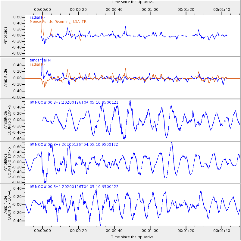
MOOW Moose Ponds, Wyoming, USA - Earthquake Result Viewer
*The percent match for this event was below the threshold and hence no stack was calculated.
| Earthquake location: |
Andreanof Islands, Aleutian Is. |
| Earthquake latitude/longitude: |
51.0/-179.9 |
| Earthquake time(UTC): |
2020/01/26 (026) 03:57:19 GMT |
| Earthquake Depth: |
4.0 km |
| Earthquake Magnitude: |
5.7 Mi |
| Earthquake Catalog/Contributor: |
NEIC PDE/at |
|
| Network: |
IW Intermountain West |
| Station: |
MOOW Moose Ponds, Wyoming, USA |
| Lat/Lon: |
43.75 N/110.74 W |
| Elevation: |
2128 m |
|
| Distance: |
45.8 deg |
| Az: |
70.829 deg |
| Baz: |
304.581 deg |
| Ray Param: |
$rayparam |
*The percent match for this event was below the threshold and hence was not used in the summary stack. |
|
| Radial Match: |
69.403404 % |
| Radial Bump: |
400 |
| Transverse Match: |
42.164967 % |
| Transverse Bump: |
400 |
| SOD ConfigId: |
20465011 |
| Insert Time: |
2020-02-09 04:04:15.235 +0000 |
| GWidth: |
2.5 |
| Max Bumps: |
400 |
| Tol: |
0.001 |
|
Signal To Noise
| Channel | StoN | STA | LTA |
| IW:MOOW:00:BHZ:20200126T04:05:10.950012Z | 3.3204548 | 5.0482305E-7 | 1.5203432E-7 |
| IW:MOOW:00:BH1:20200126T04:05:10.950012Z | 0.7775065 | 1.1655629E-7 | 1.4991038E-7 |
| IW:MOOW:00:BH2:20200126T04:05:10.950012Z | 1.7142774 | 2.894668E-7 | 1.6885646E-7 |
| Arrivals |
| Ps | |
| PpPs | |
| PsPs/PpSs | |


