You are here: Home > Network List > US - United States National Seismic Network Stations List
> Station CBKS Cedar Bluff, Kansas, USA > Earthquake Result Viewer
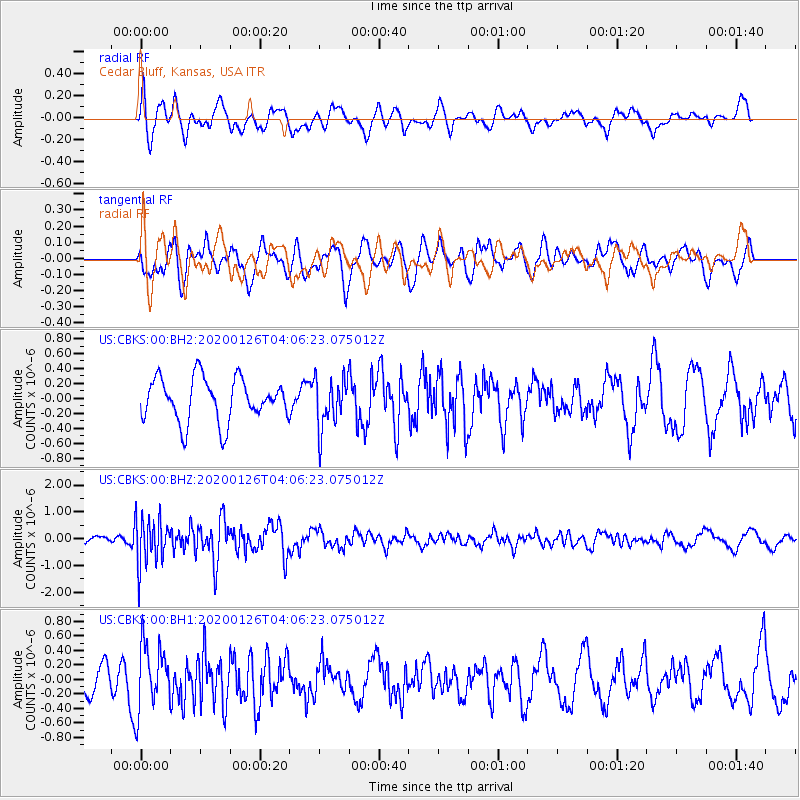
CBKS Cedar Bluff, Kansas, USA - Earthquake Result Viewer
*The percent match for this event was below the threshold and hence no stack was calculated.
| Earthquake location: |
Andreanof Islands, Aleutian Is. |
| Earthquake latitude/longitude: |
51.0/-179.9 |
| Earthquake time(UTC): |
2020/01/26 (026) 03:57:19 GMT |
| Earthquake Depth: |
4.0 km |
| Earthquake Magnitude: |
5.7 Mi |
| Earthquake Catalog/Contributor: |
NEIC PDE/at |
|
| Network: |
US United States National Seismic Network |
| Station: |
CBKS Cedar Bluff, Kansas, USA |
| Lat/Lon: |
38.81 N/99.74 W |
| Elevation: |
677 m |
|
| Distance: |
55.4 deg |
| Az: |
69.293 deg |
| Baz: |
310.856 deg |
| Ray Param: |
$rayparam |
*The percent match for this event was below the threshold and hence was not used in the summary stack. |
|
| Radial Match: |
61.7034 % |
| Radial Bump: |
400 |
| Transverse Match: |
58.75294 % |
| Transverse Bump: |
400 |
| SOD ConfigId: |
20465011 |
| Insert Time: |
2020-02-09 04:12:48.669 +0000 |
| GWidth: |
2.5 |
| Max Bumps: |
400 |
| Tol: |
0.001 |
|
Signal To Noise
| Channel | StoN | STA | LTA |
| US:CBKS:00:BHZ:20200126T04:06:23.075012Z | 5.5705824 | 8.7188243E-7 | 1.565155E-7 |
| US:CBKS:00:BH1:20200126T04:06:23.075012Z | 2.3990357 | 4.4502897E-7 | 1.8550327E-7 |
| US:CBKS:00:BH2:20200126T04:06:23.075012Z | 1.1654011 | 3.36143E-7 | 2.8843544E-7 |
| Arrivals |
| Ps | |
| PpPs | |
| PsPs/PpSs | |


