You are here: Home > Network List > US - United States National Seismic Network Stations List
> Station EGMT Eagleton, Montana, USA > Earthquake Result Viewer
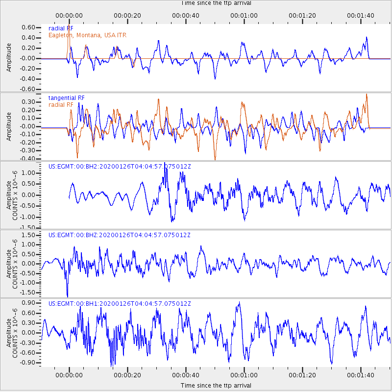
EGMT Eagleton, Montana, USA - Earthquake Result Viewer
*The percent match for this event was below the threshold and hence no stack was calculated.
| Earthquake location: |
Andreanof Islands, Aleutian Is. |
| Earthquake latitude/longitude: |
51.0/-179.9 |
| Earthquake time(UTC): |
2020/01/26 (026) 03:57:19 GMT |
| Earthquake Depth: |
4.0 km |
| Earthquake Magnitude: |
5.7 Mi |
| Earthquake Catalog/Contributor: |
NEIC PDE/at |
|
| Network: |
US United States National Seismic Network |
| Station: |
EGMT Eagleton, Montana, USA |
| Lat/Lon: |
48.02 N/109.75 W |
| Elevation: |
1055 m |
|
| Distance: |
44.1 deg |
| Az: |
65.216 deg |
| Baz: |
301.314 deg |
| Ray Param: |
$rayparam |
*The percent match for this event was below the threshold and hence was not used in the summary stack. |
|
| Radial Match: |
68.31689 % |
| Radial Bump: |
400 |
| Transverse Match: |
48.065563 % |
| Transverse Bump: |
400 |
| SOD ConfigId: |
20465011 |
| Insert Time: |
2020-02-09 04:12:52.348 +0000 |
| GWidth: |
2.5 |
| Max Bumps: |
400 |
| Tol: |
0.001 |
|
Signal To Noise
| Channel | StoN | STA | LTA |
| US:EGMT:00:BHZ:20200126T04:04:57.075012Z | 2.8500466 | 5.67865E-7 | 1.9924764E-7 |
| US:EGMT:00:BH1:20200126T04:04:57.075012Z | 0.8284431 | 3.4254285E-7 | 4.134778E-7 |
| US:EGMT:00:BH2:20200126T04:04:57.075012Z | 2.4747233 | 6.1123916E-7 | 2.4699293E-7 |
| Arrivals |
| Ps | |
| PpPs | |
| PsPs/PpSs | |


