You are here: Home > Network List > CI - Caltech Regional Seismic Network Stations List
> Station DAN Danby, California, USA > Earthquake Result Viewer
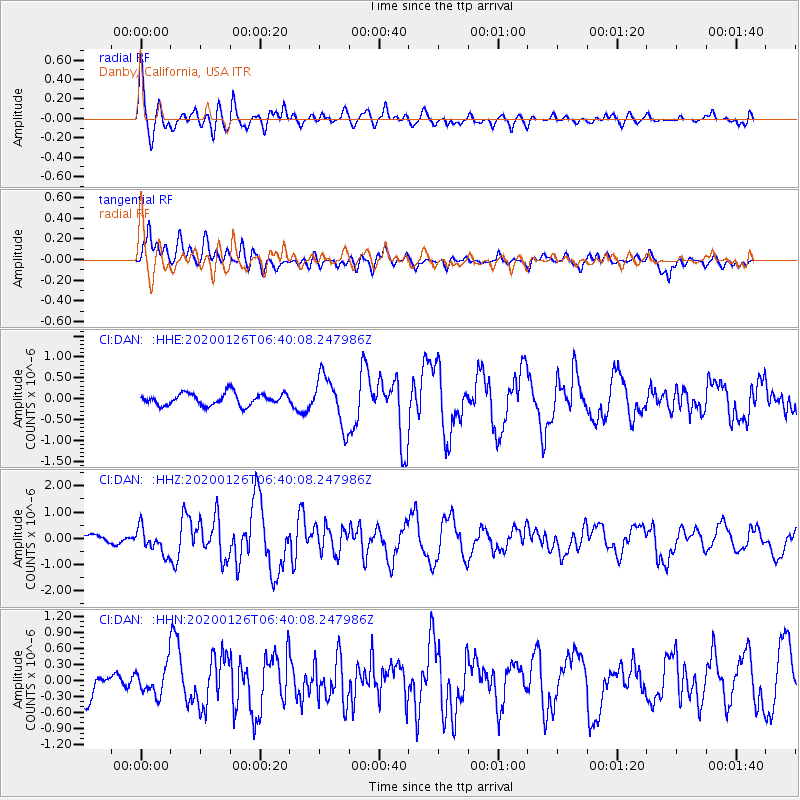
DAN Danby, California, USA - Earthquake Result Viewer
*The percent match for this event was below the threshold and hence no stack was calculated.
| Earthquake location: |
Andreanof Islands, Aleutian Is. |
| Earthquake latitude/longitude: |
50.9/-179.9 |
| Earthquake time(UTC): |
2020/01/26 (026) 06:31:55 GMT |
| Earthquake Depth: |
1.0 km |
| Earthquake Magnitude: |
5.6 Mi |
| Earthquake Catalog/Contributor: |
NEIC PDE/at |
|
| Network: |
CI Caltech Regional Seismic Network |
| Station: |
DAN Danby, California, USA |
| Lat/Lon: |
34.64 N/115.38 W |
| Elevation: |
398 m |
|
| Distance: |
48.5 deg |
| Az: |
83.621 deg |
| Baz: |
310.287 deg |
| Ray Param: |
$rayparam |
*The percent match for this event was below the threshold and hence was not used in the summary stack. |
|
| Radial Match: |
68.07576 % |
| Radial Bump: |
400 |
| Transverse Match: |
60.286022 % |
| Transverse Bump: |
400 |
| SOD ConfigId: |
20465011 |
| Insert Time: |
2020-02-09 06:35:36.441 +0000 |
| GWidth: |
2.5 |
| Max Bumps: |
400 |
| Tol: |
0.001 |
|
Signal To Noise
| Channel | StoN | STA | LTA |
| CI:DAN: :HHZ:20200126T06:40:08.247986Z | 2.6245253 | 4.8659615E-7 | 1.8540351E-7 |
| CI:DAN: :HHN:20200126T06:40:08.247986Z | 0.78540087 | 2.7572926E-7 | 3.5106817E-7 |
| CI:DAN: :HHE:20200126T06:40:08.247986Z | 4.135216 | 5.9522034E-7 | 1.4393936E-7 |
| Arrivals |
| Ps | |
| PpPs | |
| PsPs/PpSs | |


