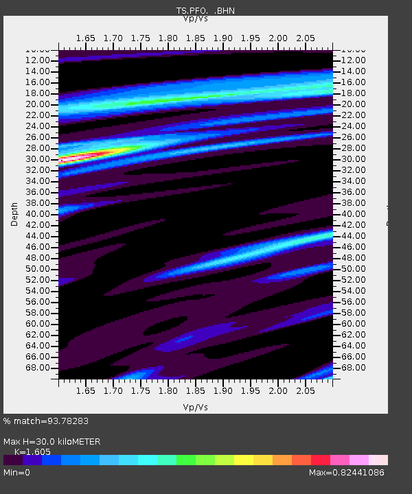
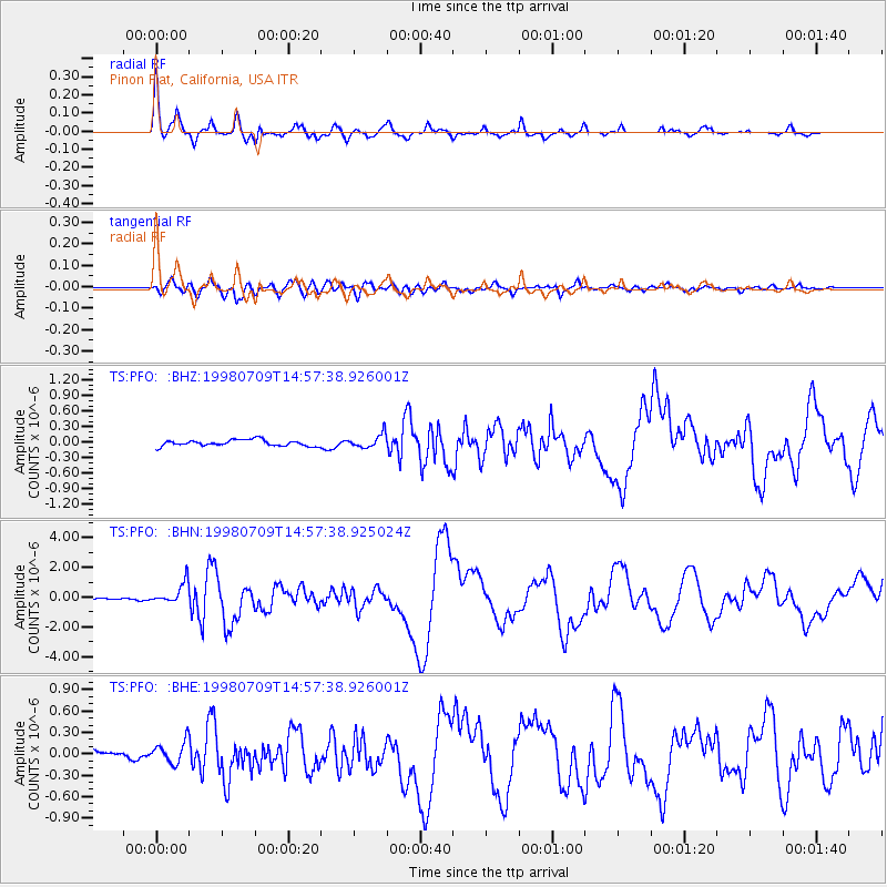
PFO Pinon Flat, California, USA - Earthquake Result Viewer

Earthquake location: Kermadec Islands, New Zealand
Earthquake latitude/longitude: -30.5/-179.0
Earthquake time(UTC): 1998/07/09 (190) 14:45:39 GMT
Earthquake Depth: 130 km
Earthquake Magnitude: 6.2 MB, 6.2 MS, 6.9 UNKNOWN, 6.4 ME
Earthquake Catalog/Contributor: WHDF/NEIC
Network: TS TERRAscope (Southern California Seismic Network)
Station: PFO Pinon Flat, California, USA
Lat/Lon: 33.61 N/116.46 W
Elevation: 1280 m
Distance: 86.9 deg
Az: 47.867 deg
Baz: 230.093 deg
Ray Param: 0.043428082
Estimated Moho Depth: 30.0 km
Estimated Crust Vp/Vs: 1.61
Assumed Crust Vp: 6.264 km/s
Estimated Crust Vs: 3.903 km/s
Estimated Crust Poisson's Ratio: 0.18
Radial Match: 93.78283 %
Radial Bump: 332
Transverse Match: 86.01959 %
Transverse Bump: 400
SOD ConfigId: 4480
Insert Time: 2010-02-26 14:40:32.925 +0000
GWidth: 2.5
Max Bumps: 400
Tol: 0.001

Signal To Noise

ChannelStoNSTALTA
TS:PFO: :BHN:19980709T14:57:38.925024Z5.91364537.248174E-71.2256695E-7
TS:PFO: :BHE:19980709T14:57:38.926001Z2.66777661.5581124E-75.84049E-8
TS:PFO: :BHZ:19980709T14:57:38.926001Z2.22716141.2985036E-75.8303076E-8
Arrivals
Ps3.0 SECOND
PpPs12 SECOND
PsPs/PpSs15 SECOND