
TUE Stuetta, Italy - Earthquake Result Viewer
| ||||||||||||||||||
| ||||||||||||||||||
| ||||||||||||||||||
|
Signal To Noise
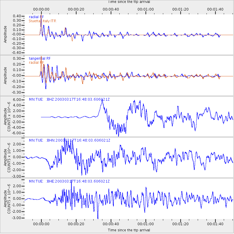
| Channel | StoN | STA | LTA |
| MN:TUE: :BHN:20030317T16:48:03.606021Z | 4.534191 | 5.1187214E-7 | 1.1289161E-7 |
| MN:TUE: :BHE:20030317T16:48:03.606021Z | 2.2702074 | 2.1332484E-7 | 9.396712E-8 |
| MN:TUE: :BHZ:20030317T16:48:03.606021Z | 16.697334 | 2.1367389E-6 | 1.2796886E-7 |
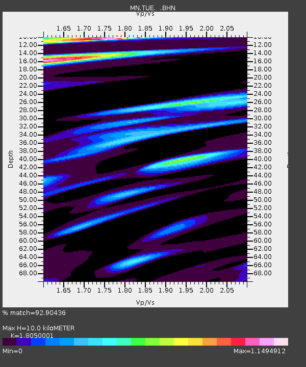
| Arrivals | |
| Ps | 1.3 SECOND |
| PpPs | 4.3 SECOND |
| PsPs/PpSs | 5.5 SECOND |

