You are here: Home > Network List > TS - TERRAscope (Southern California Seismic Network) Stations List
> Station PFO Pinon Flat, California, USA > Earthquake Result Viewer
PFO Pinon Flat, California, USA - Earthquake Result Viewer

| Earthquake location: |
Near Coast Of Nicaragua |
| Earthquake latitude/longitude: |
11.1/-86.1 |
| Earthquake time(UTC): |
1996/11/17 (322) 19:17:41 GMT |
| Earthquake Depth: |
33 km |
| Earthquake Magnitude: |
5.5 MB, 5.6 MS, 5.9 UNKNOWN, 5.9 MW |
| Earthquake Catalog/Contributor: |
WHDF/NEIC |
|
| Network: |
TS TERRAscope (Southern California Seismic Network) |
| Station: |
PFO Pinon Flat, California, USA |
| Lat/Lon: |
33.61 N/116.46 W |
| Elevation: |
1280 m |
|
| Distance: |
35.7 deg |
| Az: |
313.683 deg |
| Baz: |
121.722 deg |
| Ray Param: |
0.07700253 |
| Estimated Moho Depth: |
11.5 km |
| Estimated Crust Vp/Vs: |
1.88 |
| Assumed Crust Vp: |
6.264 km/s |
| Estimated Crust Vs: |
3.341 km/s |
| Estimated Crust Poisson's Ratio: |
0.30 |
|
| Radial Match: |
84.04092 % |
| Radial Bump: |
373 |
| Transverse Match: |
73.93834 % |
| Transverse Bump: |
400 |
| SOD ConfigId: |
4480 |
| Insert Time: |
2010-02-26 14:40:39.060 +0000 |
| GWidth: |
2.5 |
| Max Bumps: |
400 |
| Tol: |
0.001 |
|
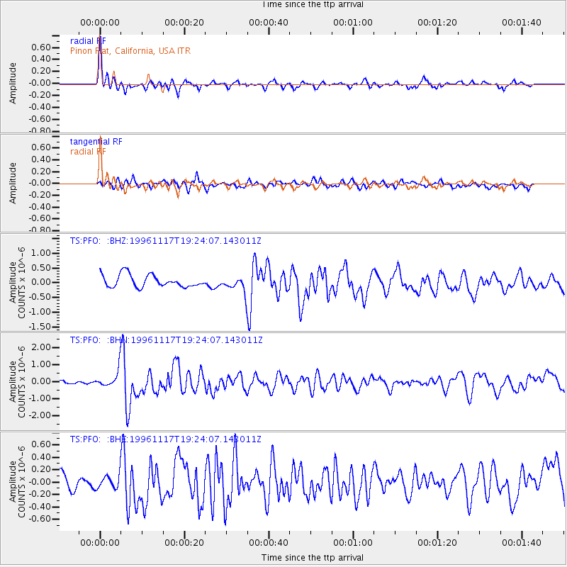
Signal To Noise
| Channel | StoN | STA | LTA |
| TS:PFO: :BHN:19961117T19:24:07.143011Z | 2.6050506 | 5.771731E-7 | 2.2155926E-7 |
| TS:PFO: :BHE:19961117T19:24:07.143011Z | 0.6454807 | 1.1656385E-7 | 1.8058456E-7 |
| TS:PFO: :BHZ:19961117T19:24:07.143011Z | 1.3537588 | 2.827301E-7 | 2.088482E-7 |
| Arrivals |
| Ps | 1.7 SECOND |
| PpPs | 4.9 SECOND |
| PsPs/PpSs | 6.7 SECOND |


