You are here: Home > Network List > US - United States National Seismic Network Stations List
> Station HAWA Hanford, Washington, USA > Earthquake Result Viewer
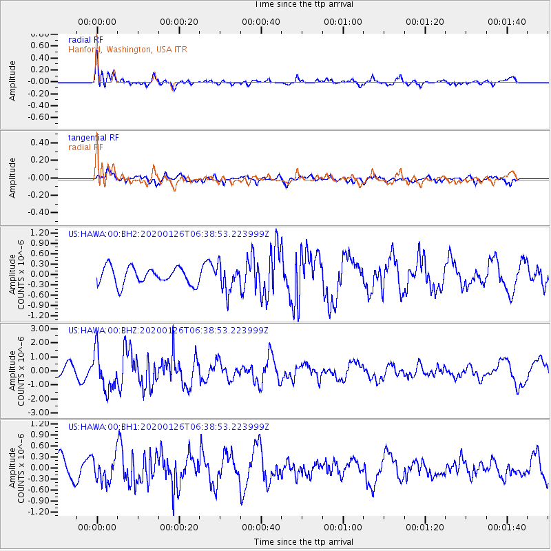
HAWA Hanford, Washington, USA - Earthquake Result Viewer
*The percent match for this event was below the threshold and hence no stack was calculated.
| Earthquake location: |
Andreanof Islands, Aleutian Is. |
| Earthquake latitude/longitude: |
50.9/-179.9 |
| Earthquake time(UTC): |
2020/01/26 (026) 06:31:55 GMT |
| Earthquake Depth: |
1.0 km |
| Earthquake Magnitude: |
5.6 Mi |
| Earthquake Catalog/Contributor: |
NEIC PDE/at |
|
| Network: |
US United States National Seismic Network |
| Station: |
HAWA Hanford, Washington, USA |
| Lat/Lon: |
46.39 N/119.53 W |
| Elevation: |
364 m |
|
| Distance: |
39.1 deg |
| Az: |
72.327 deg |
| Baz: |
299.395 deg |
| Ray Param: |
$rayparam |
*The percent match for this event was below the threshold and hence was not used in the summary stack. |
|
| Radial Match: |
59.875435 % |
| Radial Bump: |
400 |
| Transverse Match: |
49.043983 % |
| Transverse Bump: |
399 |
| SOD ConfigId: |
20465011 |
| Insert Time: |
2020-02-09 06:55:44.072 +0000 |
| GWidth: |
2.5 |
| Max Bumps: |
400 |
| Tol: |
0.001 |
|
Signal To Noise
| Channel | StoN | STA | LTA |
| US:HAWA:00:BHZ:20200126T06:38:53.223999Z | 3.497019 | 1.3768885E-6 | 3.9373202E-7 |
| US:HAWA:00:BH1:20200126T06:38:53.223999Z | 1.5898288 | 3.3296195E-7 | 2.0943257E-7 |
| US:HAWA:00:BH2:20200126T06:38:53.223999Z | 1.5497578 | 3.8355387E-7 | 2.4749278E-7 |
| Arrivals |
| Ps | |
| PpPs | |
| PsPs/PpSs | |


