You are here: Home > Network List > IW - Intermountain West Stations List
> Station MOOW Moose Ponds, Wyoming, USA > Earthquake Result Viewer
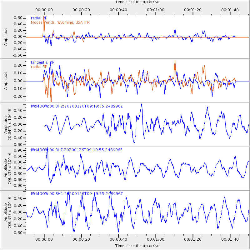
MOOW Moose Ponds, Wyoming, USA - Earthquake Result Viewer
*The percent match for this event was below the threshold and hence no stack was calculated.
| Earthquake location: |
Andreanof Islands, Aleutian Is. |
| Earthquake latitude/longitude: |
51.2/-179.8 |
| Earthquake time(UTC): |
2020/01/26 (026) 09:12:07 GMT |
| Earthquake Depth: |
24 km |
| Earthquake Magnitude: |
5.6 Mww |
| Earthquake Catalog/Contributor: |
NEIC PDE/us |
|
| Network: |
IW Intermountain West |
| Station: |
MOOW Moose Ponds, Wyoming, USA |
| Lat/Lon: |
43.75 N/110.74 W |
| Elevation: |
2128 m |
|
| Distance: |
45.7 deg |
| Az: |
71.098 deg |
| Baz: |
304.841 deg |
| Ray Param: |
$rayparam |
*The percent match for this event was below the threshold and hence was not used in the summary stack. |
|
| Radial Match: |
38.13901 % |
| Radial Bump: |
400 |
| Transverse Match: |
46.89557 % |
| Transverse Bump: |
400 |
| SOD ConfigId: |
20465011 |
| Insert Time: |
2020-02-09 09:21:03.732 +0000 |
| GWidth: |
2.5 |
| Max Bumps: |
400 |
| Tol: |
0.001 |
|
Signal To Noise
| Channel | StoN | STA | LTA |
| IW:MOOW:00:BHZ:20200126T09:19:55.248996Z | 2.2659621 | 4.996442E-7 | 2.2049981E-7 |
| IW:MOOW:00:BH1:20200126T09:19:55.248996Z | 1.4707911 | 1.86018E-7 | 1.264748E-7 |
| IW:MOOW:00:BH2:20200126T09:19:55.248996Z | 1.0868937 | 1.5042373E-7 | 1.3839785E-7 |
| Arrivals |
| Ps | |
| PpPs | |
| PsPs/PpSs | |


