You are here: Home > Network List > US - United States National Seismic Network Stations List
> Station DGMT Dagmar, Montana, USA > Earthquake Result Viewer
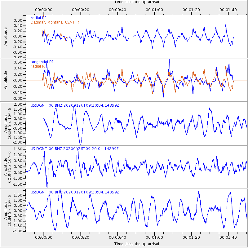
DGMT Dagmar, Montana, USA - Earthquake Result Viewer
*The percent match for this event was below the threshold and hence no stack was calculated.
| Earthquake location: |
Andreanof Islands, Aleutian Is. |
| Earthquake latitude/longitude: |
51.2/-179.8 |
| Earthquake time(UTC): |
2020/01/26 (026) 09:12:07 GMT |
| Earthquake Depth: |
24 km |
| Earthquake Magnitude: |
5.6 Mww |
| Earthquake Catalog/Contributor: |
NEIC PDE/us |
|
| Network: |
US United States National Seismic Network |
| Station: |
DGMT Dagmar, Montana, USA |
| Lat/Lon: |
48.47 N/104.20 W |
| Elevation: |
0.0 m |
|
| Distance: |
46.8 deg |
| Az: |
62.15 deg |
| Baz: |
303.356 deg |
| Ray Param: |
$rayparam |
*The percent match for this event was below the threshold and hence was not used in the summary stack. |
|
| Radial Match: |
54.15479 % |
| Radial Bump: |
382 |
| Transverse Match: |
72.43936 % |
| Transverse Bump: |
395 |
| SOD ConfigId: |
20465011 |
| Insert Time: |
2020-02-09 09:33:39.964 +0000 |
| GWidth: |
2.5 |
| Max Bumps: |
400 |
| Tol: |
0.001 |
|
Signal To Noise
| Channel | StoN | STA | LTA |
| US:DGMT:00:BHZ:20200126T09:20:04.14899Z | 2.3384178 | 7.463101E-7 | 3.1915172E-7 |
| US:DGMT:00:BH1:20200126T09:20:04.14899Z | 0.8572411 | 8.89461E-7 | 1.0375855E-6 |
| US:DGMT:00:BH2:20200126T09:20:04.14899Z | 0.6411933 | 6.279482E-7 | 9.793432E-7 |
| Arrivals |
| Ps | |
| PpPs | |
| PsPs/PpSs | |


