You are here: Home > Network List > US - United States National Seismic Network Stations List
> Station DUG Dugway, Tooele County, Utah, USA > Earthquake Result Viewer
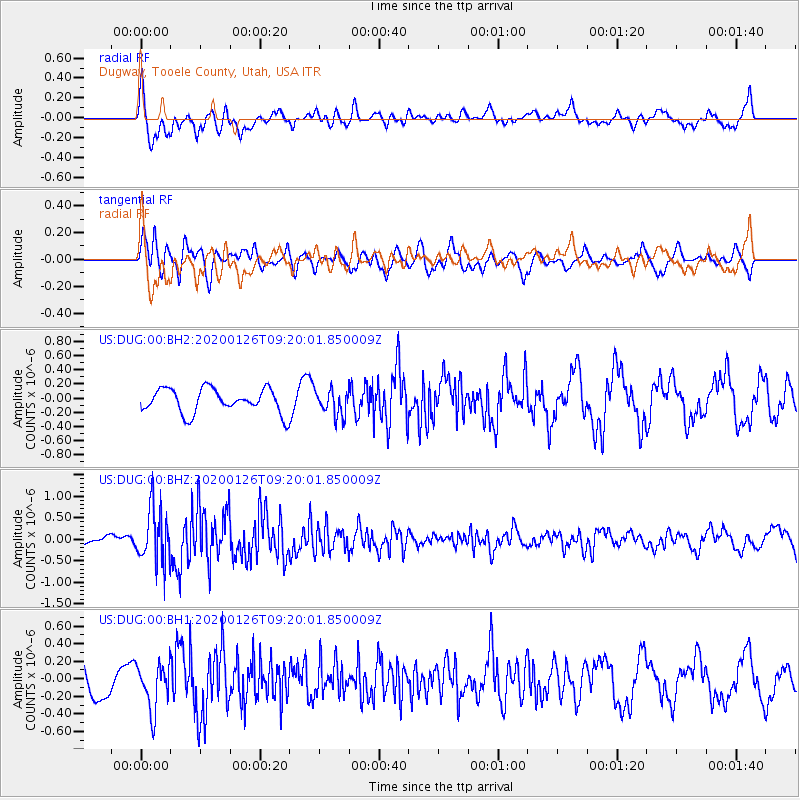
DUG Dugway, Tooele County, Utah, USA - Earthquake Result Viewer
*The percent match for this event was below the threshold and hence no stack was calculated.
| Earthquake location: |
Andreanof Islands, Aleutian Is. |
| Earthquake latitude/longitude: |
51.2/-179.8 |
| Earthquake time(UTC): |
2020/01/26 (026) 09:12:07 GMT |
| Earthquake Depth: |
24 km |
| Earthquake Magnitude: |
5.6 Mww |
| Earthquake Catalog/Contributor: |
NEIC PDE/us |
|
| Network: |
US United States National Seismic Network |
| Station: |
DUG Dugway, Tooele County, Utah, USA |
| Lat/Lon: |
40.19 N/112.81 W |
| Elevation: |
1477 m |
|
| Distance: |
46.5 deg |
| Az: |
76.345 deg |
| Baz: |
307.102 deg |
| Ray Param: |
$rayparam |
*The percent match for this event was below the threshold and hence was not used in the summary stack. |
|
| Radial Match: |
60.557194 % |
| Radial Bump: |
400 |
| Transverse Match: |
67.529045 % |
| Transverse Bump: |
400 |
| SOD ConfigId: |
20465011 |
| Insert Time: |
2020-02-09 09:33:41.595 +0000 |
| GWidth: |
2.5 |
| Max Bumps: |
400 |
| Tol: |
0.001 |
|
Signal To Noise
| Channel | StoN | STA | LTA |
| US:DUG:00:BHZ:20200126T09:20:01.850009Z | 4.5799503 | 6.232122E-7 | 1.3607401E-7 |
| US:DUG:00:BH1:20200126T09:20:01.850009Z | 1.5386295 | 2.6418584E-7 | 1.7170206E-7 |
| US:DUG:00:BH2:20200126T09:20:01.850009Z | 1.0558175 | 1.797771E-7 | 1.7027291E-7 |
| Arrivals |
| Ps | |
| PpPs | |
| PsPs/PpSs | |


