You are here: Home > Network List > US - United States National Seismic Network Stations List
> Station MNTX Cornudas Mountains, Texas, USA > Earthquake Result Viewer
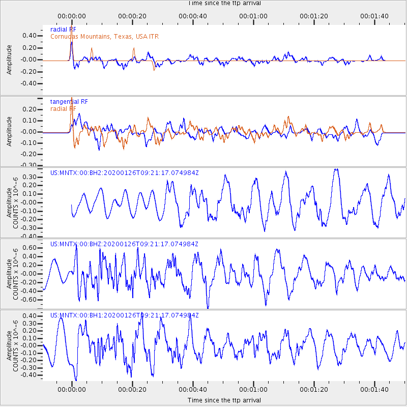
MNTX Cornudas Mountains, Texas, USA - Earthquake Result Viewer
*The percent match for this event was below the threshold and hence no stack was calculated.
| Earthquake location: |
Andreanof Islands, Aleutian Is. |
| Earthquake latitude/longitude: |
51.2/-179.8 |
| Earthquake time(UTC): |
2020/01/26 (026) 09:12:07 GMT |
| Earthquake Depth: |
24 km |
| Earthquake Magnitude: |
5.6 Mww |
| Earthquake Catalog/Contributor: |
NEIC PDE/us |
|
| Network: |
US United States National Seismic Network |
| Station: |
MNTX Cornudas Mountains, Texas, USA |
| Lat/Lon: |
31.70 N/105.38 W |
| Elevation: |
404 m |
|
| Distance: |
56.6 deg |
| Az: |
79.602 deg |
| Baz: |
313.494 deg |
| Ray Param: |
$rayparam |
*The percent match for this event was below the threshold and hence was not used in the summary stack. |
|
| Radial Match: |
60.758385 % |
| Radial Bump: |
400 |
| Transverse Match: |
43.404938 % |
| Transverse Bump: |
400 |
| SOD ConfigId: |
20465011 |
| Insert Time: |
2020-02-09 09:34:02.909 +0000 |
| GWidth: |
2.5 |
| Max Bumps: |
400 |
| Tol: |
0.001 |
|
Signal To Noise
| Channel | StoN | STA | LTA |
| US:MNTX:00:BHZ:20200126T09:21:17.074984Z | 1.8886373 | 3.339027E-7 | 1.7679557E-7 |
| US:MNTX:00:BH1:20200126T09:21:17.074984Z | 2.659667 | 2.8364903E-7 | 1.0664832E-7 |
| US:MNTX:00:BH2:20200126T09:21:17.074984Z | 1.7473406 | 1.7165854E-7 | 9.8239894E-8 |
| Arrivals |
| Ps | |
| PpPs | |
| PsPs/PpSs | |


