You are here: Home > Network List > GS - US Geological Survey Networks Stations List
> Station OK031 S. Brethren Rd., Cushing, OK, USA > Earthquake Result Viewer
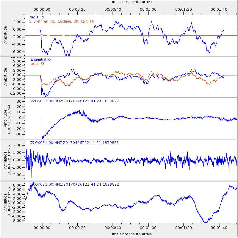
OK031 S. Brethren Rd., Cushing, OK, USA - Earthquake Result Viewer
*The percent match for this event was below the threshold and hence no stack was calculated.
| Earthquake location: |
Pacific-Antarctic Ridge |
| Earthquake latitude/longitude: |
-54.9/-130.3 |
| Earthquake time(UTC): |
2017/04/26 (116) 22:28:30 GMT |
| Earthquake Depth: |
10 km |
| Earthquake Magnitude: |
5.5 Mwb |
| Earthquake Catalog/Contributor: |
NEIC PDE/us |
|
| Network: |
GS US Geological Survey Networks |
| Station: |
OK031 S. Brethren Rd., Cushing, OK, USA |
| Lat/Lon: |
35.95 N/96.84 W |
| Elevation: |
290 m |
|
| Distance: |
94.9 deg |
| Az: |
26.683 deg |
| Baz: |
198.655 deg |
| Ray Param: |
$rayparam |
*The percent match for this event was below the threshold and hence was not used in the summary stack. |
|
| Radial Match: |
29.594643 % |
| Radial Bump: |
400 |
| Transverse Match: |
54.063652 % |
| Transverse Bump: |
400 |
| SOD ConfigId: |
2028011 |
| Insert Time: |
2017-05-10 22:33:31.387 +0000 |
| GWidth: |
2.5 |
| Max Bumps: |
400 |
| Tol: |
0.001 |
|
Signal To Noise
| Channel | StoN | STA | LTA |
| GS:OK031:00:HHZ:20170426T22:41:21.183982Z | 0.7857098 | 4.064172E-7 | 5.172612E-7 |
| GS:OK031:00:HH1:20170426T22:41:21.183982Z | 1.1029428 | 6.498516E-6 | 5.8919786E-6 |
| GS:OK031:00:HH2:20170426T22:41:21.183982Z | 0.12687172 | 1.8541602E-6 | 1.4614449E-5 |
| Arrivals |
| Ps | |
| PpPs | |
| PsPs/PpSs | |


