You are here: Home > Network List > UU - University of Utah Regional Network Stations List
> Station FOR4 Blundell West, UT, USA > Earthquake Result Viewer
FOR4 Blundell West, UT, USA - Earthquake Result Viewer
*The percent match for this event was below the threshold and hence no stack was calculated.
| Earthquake location: |
Pacific-Antarctic Ridge |
| Earthquake latitude/longitude: |
-54.9/-130.3 |
| Earthquake time(UTC): |
2017/04/26 (116) 22:28:30 GMT |
| Earthquake Depth: |
10 km |
| Earthquake Magnitude: |
5.5 Mwb |
| Earthquake Catalog/Contributor: |
NEIC PDE/us |
|
| Network: |
UU University of Utah Regional Network |
| Station: |
FOR4 Blundell West, UT, USA |
| Lat/Lon: |
38.50 N/112.90 W |
| Elevation: |
1657 m |
|
| Distance: |
94.2 deg |
| Az: |
13.613 deg |
| Baz: |
189.983 deg |
| Ray Param: |
$rayparam |
*The percent match for this event was below the threshold and hence was not used in the summary stack. |
|
| Radial Match: |
16.334675 % |
| Radial Bump: |
400 |
| Transverse Match: |
17.41334 % |
| Transverse Bump: |
400 |
| SOD ConfigId: |
2028011 |
| Insert Time: |
2017-05-10 22:35:30.739 +0000 |
| GWidth: |
2.5 |
| Max Bumps: |
400 |
| Tol: |
0.001 |
|
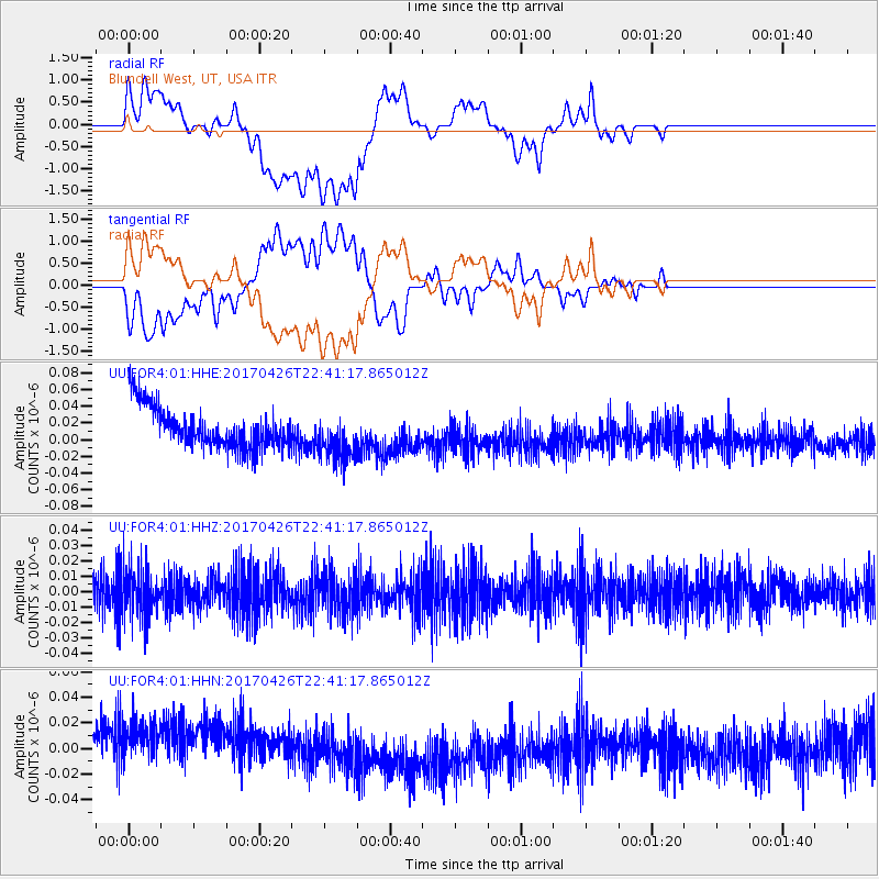
Signal To Noise
| Channel | StoN | STA | LTA |
| UU:FOR4:01:HHZ:20170426T22:41:17.865012Z | 1.4080716 | 1.5940342E-8 | 1.1320689E-8 |
| UU:FOR4:01:HHN:20170426T22:41:17.865012Z | 1.0252826 | 3.7420172E-8 | 3.649742E-8 |
| UU:FOR4:01:HHE:20170426T22:41:17.865012Z | 1.1324805 | 2.8286884E-8 | 2.4977812E-8 |
| Arrivals |
| Ps | |
| PpPs | |
| PsPs/PpSs | |


