You are here: Home > Network List > US - United States National Seismic Network Stations List
> Station MIAR Mount Ida, Arkansas, USA > Earthquake Result Viewer
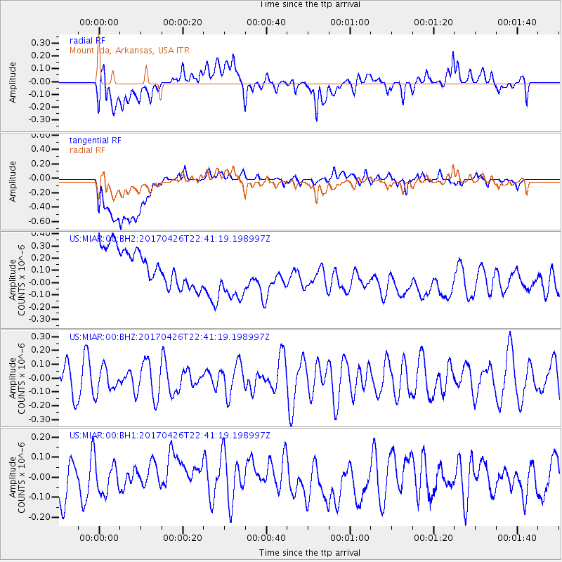
MIAR Mount Ida, Arkansas, USA - Earthquake Result Viewer
*The percent match for this event was below the threshold and hence no stack was calculated.
| Earthquake location: |
Pacific-Antarctic Ridge |
| Earthquake latitude/longitude: |
-54.9/-130.3 |
| Earthquake time(UTC): |
2017/04/26 (116) 22:28:30 GMT |
| Earthquake Depth: |
10 km |
| Earthquake Magnitude: |
5.5 Mwb |
| Earthquake Catalog/Contributor: |
NEIC PDE/us |
|
| Network: |
US United States National Seismic Network |
| Station: |
MIAR Mount Ida, Arkansas, USA |
| Lat/Lon: |
34.55 N/93.58 W |
| Elevation: |
207 m |
|
| Distance: |
94.5 deg |
| Az: |
29.679 deg |
| Baz: |
200.284 deg |
| Ray Param: |
$rayparam |
*The percent match for this event was below the threshold and hence was not used in the summary stack. |
|
| Radial Match: |
33.598064 % |
| Radial Bump: |
400 |
| Transverse Match: |
32.373615 % |
| Transverse Bump: |
400 |
| SOD ConfigId: |
2028011 |
| Insert Time: |
2017-05-10 22:35:40.628 +0000 |
| GWidth: |
2.5 |
| Max Bumps: |
400 |
| Tol: |
0.001 |
|
Signal To Noise
| Channel | StoN | STA | LTA |
| US:MIAR:00:BHZ:20170426T22:41:19.198997Z | 0.5871004 | 8.6605766E-8 | 1.4751441E-7 |
| US:MIAR:00:BH1:20170426T22:41:19.198997Z | 0.687806 | 6.980184E-8 | 1.0148478E-7 |
| US:MIAR:00:BH2:20170426T22:41:19.198997Z | 1.5383962 | 2.2330396E-7 | 1.4515373E-7 |
| Arrivals |
| Ps | |
| PpPs | |
| PsPs/PpSs | |


