You are here: Home > Network List > US - United States National Seismic Network Stations List
> Station WMOK Wichita Mountains, Oklahoma, USA > Earthquake Result Viewer
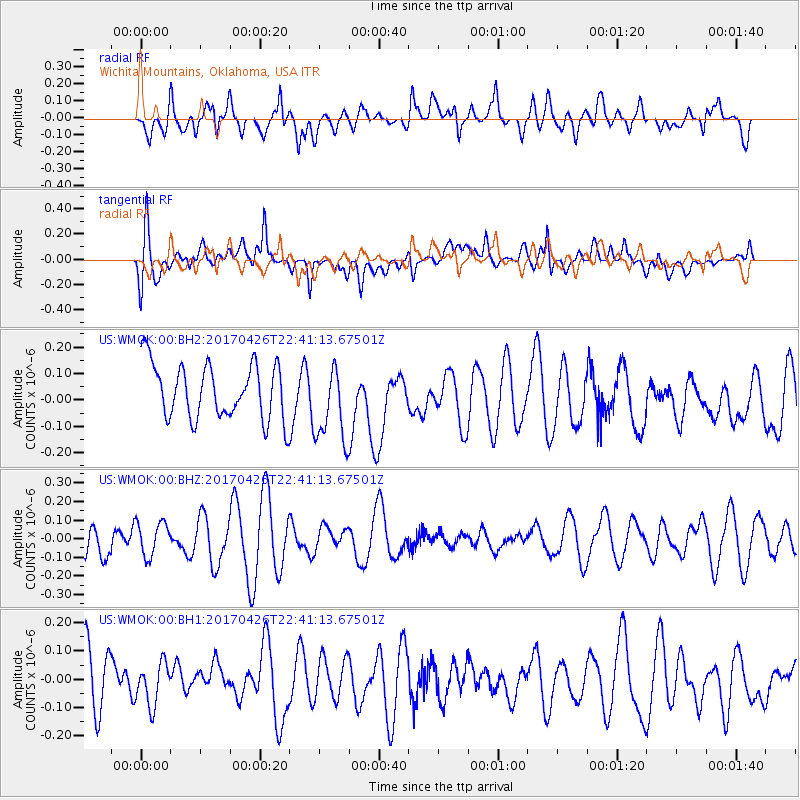
WMOK Wichita Mountains, Oklahoma, USA - Earthquake Result Viewer
*The percent match for this event was below the threshold and hence no stack was calculated.
| Earthquake location: |
Pacific-Antarctic Ridge |
| Earthquake latitude/longitude: |
-54.9/-130.3 |
| Earthquake time(UTC): |
2017/04/26 (116) 22:28:30 GMT |
| Earthquake Depth: |
10 km |
| Earthquake Magnitude: |
5.5 Mwb |
| Earthquake Catalog/Contributor: |
NEIC PDE/us |
|
| Network: |
US United States National Seismic Network |
| Station: |
WMOK Wichita Mountains, Oklahoma, USA |
| Lat/Lon: |
34.74 N/98.78 W |
| Elevation: |
486 m |
|
| Distance: |
93.3 deg |
| Az: |
25.549 deg |
| Baz: |
197.618 deg |
| Ray Param: |
$rayparam |
*The percent match for this event was below the threshold and hence was not used in the summary stack. |
|
| Radial Match: |
52.77792 % |
| Radial Bump: |
400 |
| Transverse Match: |
51.721443 % |
| Transverse Bump: |
400 |
| SOD ConfigId: |
2028011 |
| Insert Time: |
2017-05-10 22:35:51.131 +0000 |
| GWidth: |
2.5 |
| Max Bumps: |
400 |
| Tol: |
0.001 |
|
Signal To Noise
| Channel | StoN | STA | LTA |
| US:WMOK:00:BHZ:20170426T22:41:13.67501Z | 0.62430656 | 9.05332E-8 | 1.4501401E-7 |
| US:WMOK:00:BH1:20170426T22:41:13.67501Z | 0.5642645 | 7.376089E-8 | 1.3072042E-7 |
| US:WMOK:00:BH2:20170426T22:41:13.67501Z | 1.4267057 | 1.4855313E-7 | 1.04123174E-7 |
| Arrivals |
| Ps | |
| PpPs | |
| PsPs/PpSs | |


