You are here: Home > Network List > UU - University of Utah Regional Network Stations List
> Station CCUT Cedar City, UT, USA > Earthquake Result Viewer
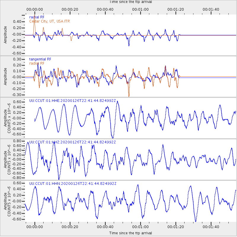
CCUT Cedar City, UT, USA - Earthquake Result Viewer
*The percent match for this event was below the threshold and hence no stack was calculated.
| Earthquake location: |
Andreanof Islands, Aleutian Is. |
| Earthquake latitude/longitude: |
51.3/-180.0 |
| Earthquake time(UTC): |
2020/01/26 (026) 22:33:40 GMT |
| Earthquake Depth: |
35 km |
| Earthquake Magnitude: |
5.7 Mww |
| Earthquake Catalog/Contributor: |
NEIC PDE/us |
|
| Network: |
UU University of Utah Regional Network |
| Station: |
CCUT Cedar City, UT, USA |
| Lat/Lon: |
37.55 N/113.36 W |
| Elevation: |
2127 m |
|
| Distance: |
47.9 deg |
| Az: |
79.486 deg |
| Baz: |
309.067 deg |
| Ray Param: |
$rayparam |
*The percent match for this event was below the threshold and hence was not used in the summary stack. |
|
| Radial Match: |
34.820934 % |
| Radial Bump: |
294 |
| Transverse Match: |
52.574604 % |
| Transverse Bump: |
400 |
| SOD ConfigId: |
20465011 |
| Insert Time: |
2020-02-09 23:05:46.403 +0000 |
| GWidth: |
2.5 |
| Max Bumps: |
400 |
| Tol: |
0.001 |
|
Signal To Noise
| Channel | StoN | STA | LTA |
| UU:CCUT:01:HHZ:20200126T22:41:44.824992Z | 1.7678081 | 4.5023592E-7 | 2.5468594E-7 |
| UU:CCUT:01:HHN:20200126T22:41:44.824992Z | 1.2802929 | 3.448449E-7 | 2.6934845E-7 |
| UU:CCUT:01:HHE:20200126T22:41:44.824992Z | 0.6096074 | 1.9707188E-7 | 3.232767E-7 |
| Arrivals |
| Ps | |
| PpPs | |
| PsPs/PpSs | |


