You are here: Home > Network List > CI - Caltech Regional Seismic Network Stations List
> Station DAN Danby, California, USA > Earthquake Result Viewer
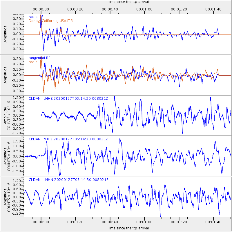
DAN Danby, California, USA - Earthquake Result Viewer
*The percent match for this event was below the threshold and hence no stack was calculated.
| Earthquake location: |
Solomon Islands |
| Earthquake latitude/longitude: |
-10.1/161.0 |
| Earthquake time(UTC): |
2020/01/27 (027) 05:02:01 GMT |
| Earthquake Depth: |
18 km |
| Earthquake Magnitude: |
6.3 Mww |
| Earthquake Catalog/Contributor: |
NEIC PDE/us |
|
| Network: |
CI Caltech Regional Seismic Network |
| Station: |
DAN Danby, California, USA |
| Lat/Lon: |
34.64 N/115.38 W |
| Elevation: |
398 m |
|
| Distance: |
90.5 deg |
| Az: |
55.028 deg |
| Baz: |
258.118 deg |
| Ray Param: |
$rayparam |
*The percent match for this event was below the threshold and hence was not used in the summary stack. |
|
| Radial Match: |
74.20788 % |
| Radial Bump: |
400 |
| Transverse Match: |
64.83605 % |
| Transverse Bump: |
400 |
| SOD ConfigId: |
20465011 |
| Insert Time: |
2020-02-10 05:08:26.892 +0000 |
| GWidth: |
2.5 |
| Max Bumps: |
400 |
| Tol: |
0.001 |
|
Signal To Noise
| Channel | StoN | STA | LTA |
| CI:DAN: :HHZ:20200127T05:14:30.008021Z | 5.3121924 | 7.362415E-7 | 1.3859464E-7 |
| CI:DAN: :HHN:20200127T05:14:30.008021Z | 1.1947422 | 3.7417107E-7 | 3.1318143E-7 |
| CI:DAN: :HHE:20200127T05:14:30.008021Z | 2.246325 | 3.336412E-7 | 1.4852756E-7 |
| Arrivals |
| Ps | |
| PpPs | |
| PsPs/PpSs | |


