You are here: Home > Network List > TA - USArray Transportable Network (new EarthScope stations) Stations List
> Station H31M Peel River, Yukon, CAN > Earthquake Result Viewer
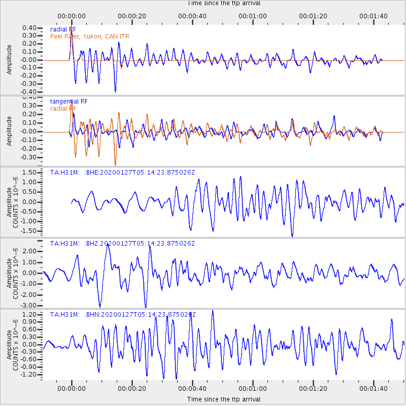
H31M Peel River, Yukon, CAN - Earthquake Result Viewer
*The percent match for this event was below the threshold and hence no stack was calculated.
| Earthquake location: |
Solomon Islands |
| Earthquake latitude/longitude: |
-10.1/161.0 |
| Earthquake time(UTC): |
2020/01/27 (027) 05:02:01 GMT |
| Earthquake Depth: |
18 km |
| Earthquake Magnitude: |
6.3 Mww |
| Earthquake Catalog/Contributor: |
NEIC PDE/us |
|
| Network: |
TA USArray Transportable Network (new EarthScope stations) |
| Station: |
H31M Peel River, Yukon, CAN |
| Lat/Lon: |
65.81 N/134.34 W |
| Elevation: |
642 m |
|
| Distance: |
89.1 deg |
| Az: |
21.866 deg |
| Baz: |
242.854 deg |
| Ray Param: |
$rayparam |
*The percent match for this event was below the threshold and hence was not used in the summary stack. |
|
| Radial Match: |
81.206055 % |
| Radial Bump: |
400 |
| Transverse Match: |
77.76738 % |
| Transverse Bump: |
400 |
| SOD ConfigId: |
20465011 |
| Insert Time: |
2020-02-10 05:15:56.374 +0000 |
| GWidth: |
2.5 |
| Max Bumps: |
400 |
| Tol: |
0.001 |
|
Signal To Noise
| Channel | StoN | STA | LTA |
| TA:H31M: :BHZ:20200127T05:14:23.875026Z | 2.7067926 | 8.3727787E-7 | 3.0932472E-7 |
| TA:H31M: :BHN:20200127T05:14:23.875026Z | 0.85997534 | 2.1229965E-7 | 2.4686716E-7 |
| TA:H31M: :BHE:20200127T05:14:23.875026Z | 1.159192 | 3.2933934E-7 | 2.8411114E-7 |
| Arrivals |
| Ps | |
| PpPs | |
| PsPs/PpSs | |


