You are here: Home > Network List > TA - USArray Transportable Network (new EarthScope stations) Stations List
> Station M16K Timber Creek, AK, USA > Earthquake Result Viewer
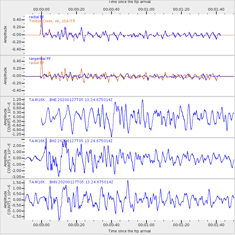
M16K Timber Creek, AK, USA - Earthquake Result Viewer
*The percent match for this event was below the threshold and hence no stack was calculated.
| Earthquake location: |
Solomon Islands |
| Earthquake latitude/longitude: |
-10.1/161.0 |
| Earthquake time(UTC): |
2020/01/27 (027) 05:02:01 GMT |
| Earthquake Depth: |
18 km |
| Earthquake Magnitude: |
6.3 Mww |
| Earthquake Catalog/Contributor: |
NEIC PDE/us |
|
| Network: |
TA USArray Transportable Network (new EarthScope stations) |
| Station: |
M16K Timber Creek, AK, USA |
| Lat/Lon: |
61.02 N/158.96 W |
| Elevation: |
394 m |
|
| Distance: |
77.6 deg |
| Az: |
18.7 deg |
| Baz: |
220.415 deg |
| Ray Param: |
$rayparam |
*The percent match for this event was below the threshold and hence was not used in the summary stack. |
|
| Radial Match: |
71.36409 % |
| Radial Bump: |
363 |
| Transverse Match: |
45.737534 % |
| Transverse Bump: |
400 |
| SOD ConfigId: |
20465011 |
| Insert Time: |
2020-02-10 05:16:27.994 +0000 |
| GWidth: |
2.5 |
| Max Bumps: |
400 |
| Tol: |
0.001 |
|
Signal To Noise
| Channel | StoN | STA | LTA |
| TA:M16K: :BHZ:20200127T05:13:24.675014Z | 4.991122 | 1.1903845E-6 | 2.385004E-7 |
| TA:M16K: :BHN:20200127T05:13:24.675014Z | 1.568472 | 4.357993E-7 | 2.778496E-7 |
| TA:M16K: :BHE:20200127T05:13:24.675014Z | 0.8929574 | 3.888071E-7 | 4.3541507E-7 |
| Arrivals |
| Ps | |
| PpPs | |
| PsPs/PpSs | |


