You are here: Home > Network List > US - United States National Seismic Network Stations List
> Station ELK Elko, Nevada, USA > Earthquake Result Viewer
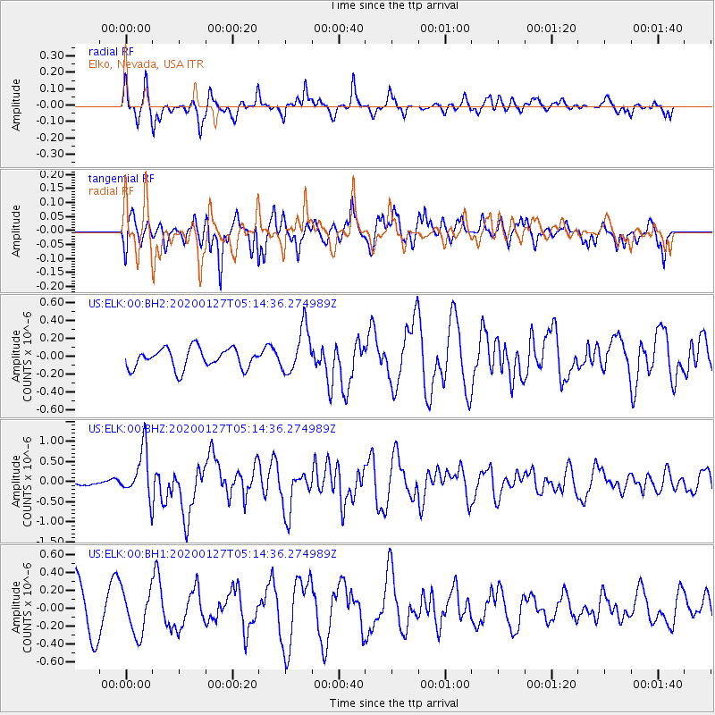
ELK Elko, Nevada, USA - Earthquake Result Viewer
*The percent match for this event was below the threshold and hence no stack was calculated.
| Earthquake location: |
Solomon Islands |
| Earthquake latitude/longitude: |
-10.1/161.0 |
| Earthquake time(UTC): |
2020/01/27 (027) 05:02:01 GMT |
| Earthquake Depth: |
18 km |
| Earthquake Magnitude: |
6.3 Mww |
| Earthquake Catalog/Contributor: |
NEIC PDE/us |
|
| Network: |
US United States National Seismic Network |
| Station: |
ELK Elko, Nevada, USA |
| Lat/Lon: |
40.74 N/115.24 W |
| Elevation: |
2210 m |
|
| Distance: |
91.8 deg |
| Az: |
49.081 deg |
| Baz: |
258.323 deg |
| Ray Param: |
$rayparam |
*The percent match for this event was below the threshold and hence was not used in the summary stack. |
|
| Radial Match: |
57.430958 % |
| Radial Bump: |
343 |
| Transverse Match: |
46.19246 % |
| Transverse Bump: |
349 |
| SOD ConfigId: |
20465011 |
| Insert Time: |
2020-02-10 05:17:55.214 +0000 |
| GWidth: |
2.5 |
| Max Bumps: |
400 |
| Tol: |
0.001 |
|
Signal To Noise
| Channel | StoN | STA | LTA |
| US:ELK:00:BHZ:20200127T05:14:36.274989Z | 3.1582756 | 5.9643014E-7 | 1.8884677E-7 |
| US:ELK:00:BH1:20200127T05:14:36.274989Z | 0.8575044 | 2.422528E-7 | 2.8250912E-7 |
| US:ELK:00:BH2:20200127T05:14:36.274989Z | 2.2842276 | 2.5438737E-7 | 1.1136691E-7 |
| Arrivals |
| Ps | |
| PpPs | |
| PsPs/PpSs | |


