You are here: Home > Network List > UU - University of Utah Regional Network Stations List
> Station CCUT Cedar City, UT, USA > Earthquake Result Viewer
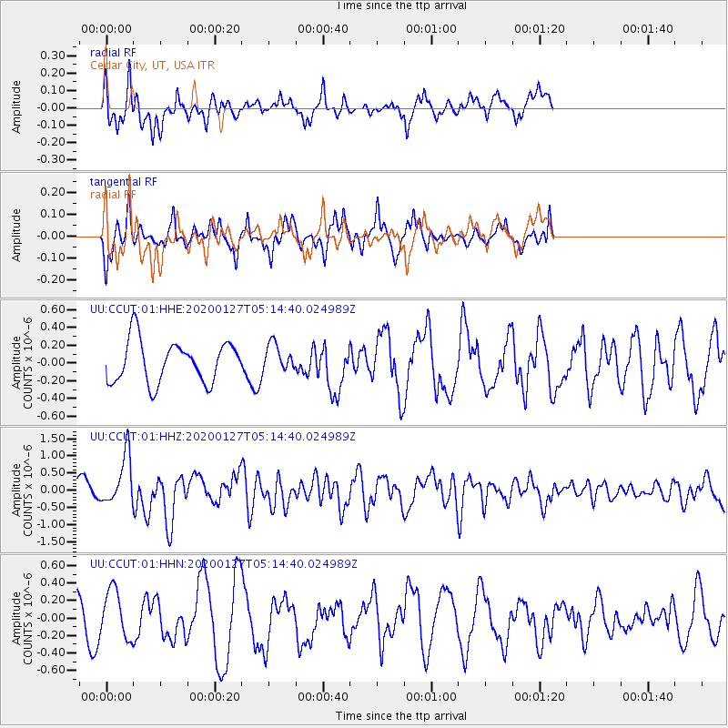
CCUT Cedar City, UT, USA - Earthquake Result Viewer
*The percent match for this event was below the threshold and hence no stack was calculated.
| Earthquake location: |
Solomon Islands |
| Earthquake latitude/longitude: |
-10.1/161.0 |
| Earthquake time(UTC): |
2020/01/27 (027) 05:02:01 GMT |
| Earthquake Depth: |
18 km |
| Earthquake Magnitude: |
6.3 Mww |
| Earthquake Catalog/Contributor: |
NEIC PDE/us |
|
| Network: |
UU University of Utah Regional Network |
| Station: |
CCUT Cedar City, UT, USA |
| Lat/Lon: |
37.55 N/113.36 W |
| Elevation: |
2127 m |
|
| Distance: |
92.6 deg |
| Az: |
52.495 deg |
| Baz: |
259.37 deg |
| Ray Param: |
$rayparam |
*The percent match for this event was below the threshold and hence was not used in the summary stack. |
|
| Radial Match: |
68.79693 % |
| Radial Bump: |
400 |
| Transverse Match: |
43.369034 % |
| Transverse Bump: |
367 |
| SOD ConfigId: |
20465011 |
| Insert Time: |
2020-02-10 05:18:06.634 +0000 |
| GWidth: |
2.5 |
| Max Bumps: |
400 |
| Tol: |
0.001 |
|
Signal To Noise
| Channel | StoN | STA | LTA |
| UU:CCUT:01:HHZ:20200127T05:14:40.024989Z | 2.990406 | 7.3691393E-7 | 2.4642603E-7 |
| UU:CCUT:01:HHN:20200127T05:14:40.024989Z | 1.3042783 | 2.723456E-7 | 2.0880942E-7 |
| UU:CCUT:01:HHE:20200127T05:14:40.024989Z | 0.65583193 | 1.5407473E-7 | 2.3493018E-7 |
| Arrivals |
| Ps | |
| PpPs | |
| PsPs/PpSs | |


