You are here: Home > Network List > UU - University of Utah Regional Network Stations List
> Station PSUT Pine Spring, UT, USA > Earthquake Result Viewer
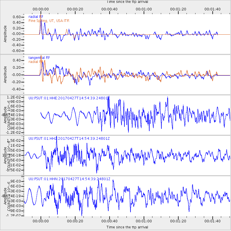
PSUT Pine Spring, UT, USA - Earthquake Result Viewer
*The percent match for this event was below the threshold and hence no stack was calculated.
| Earthquake location: |
Rat Islands, Aleutian Islands |
| Earthquake latitude/longitude: |
51.3/178.6 |
| Earthquake time(UTC): |
2017/04/27 (117) 14:46:33 GMT |
| Earthquake Depth: |
19 km |
| Earthquake Magnitude: |
5.7 Mww |
| Earthquake Catalog/Contributor: |
NEIC PDE/us |
|
| Network: |
UU University of Utah Regional Network |
| Station: |
PSUT Pine Spring, UT, USA |
| Lat/Lon: |
38.53 N/113.85 W |
| Elevation: |
1999 m |
|
| Distance: |
47.9 deg |
| Az: |
77.802 deg |
| Baz: |
308.451 deg |
| Ray Param: |
$rayparam |
*The percent match for this event was below the threshold and hence was not used in the summary stack. |
|
| Radial Match: |
69.16003 % |
| Radial Bump: |
400 |
| Transverse Match: |
63.58373 % |
| Transverse Bump: |
400 |
| SOD ConfigId: |
2028011 |
| Insert Time: |
2017-05-11 14:53:53.266 +0000 |
| GWidth: |
2.5 |
| Max Bumps: |
400 |
| Tol: |
0.001 |
|
Signal To Noise
| Channel | StoN | STA | LTA |
| UU:PSUT:01:HHZ:20170427T14:54:39.24801Z | 1.9774245 | 5.7995693E-9 | 2.9328904E-9 |
| UU:PSUT:01:HHN:20170427T14:54:39.24801Z | 1.4235116 | 3.4404428E-9 | 2.4168703E-9 |
| UU:PSUT:01:HHE:20170427T14:54:39.24801Z | 1.295018 | 3.2257412E-9 | 2.4908853E-9 |
| Arrivals |
| Ps | |
| PpPs | |
| PsPs/PpSs | |


