You are here: Home > Network List > TA - USArray Transportable Network (new EarthScope stations) Stations List
> Station F21K Alatna River, AK, USA > Earthquake Result Viewer
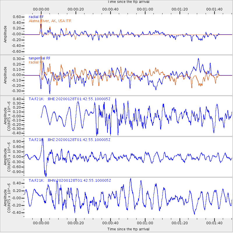
F21K Alatna River, AK, USA - Earthquake Result Viewer
*The percent match for this event was below the threshold and hence no stack was calculated.
| Earthquake location: |
Hokkaido, Japan Region |
| Earthquake latitude/longitude: |
43.6/145.9 |
| Earthquake time(UTC): |
2020/01/28 (028) 01:36:02 GMT |
| Earthquake Depth: |
79 km |
| Earthquake Magnitude: |
5.5 mb |
| Earthquake Catalog/Contributor: |
NEIC PDE/us |
|
| Network: |
TA USArray Transportable Network (new EarthScope stations) |
| Station: |
F21K Alatna River, AK, USA |
| Lat/Lon: |
67.22 N/153.48 W |
| Elevation: |
597 m |
|
| Distance: |
39.5 deg |
| Az: |
32.214 deg |
| Baz: |
264.437 deg |
| Ray Param: |
$rayparam |
*The percent match for this event was below the threshold and hence was not used in the summary stack. |
|
| Radial Match: |
62.08504 % |
| Radial Bump: |
400 |
| Transverse Match: |
55.979992 % |
| Transverse Bump: |
400 |
| SOD ConfigId: |
20465011 |
| Insert Time: |
2020-02-11 01:51:45.447 +0000 |
| GWidth: |
2.5 |
| Max Bumps: |
400 |
| Tol: |
0.001 |
|
Signal To Noise
| Channel | StoN | STA | LTA |
| TA:F21K: :BHZ:20200128T01:42:55.100005Z | 5.7351265 | 6.2294845E-7 | 1.0861983E-7 |
| TA:F21K: :BHN:20200128T01:42:55.100005Z | 1.3588847 | 1.9258458E-7 | 1.4172254E-7 |
| TA:F21K: :BHE:20200128T01:42:55.100005Z | 1.279893 | 2.1862051E-7 | 1.7081156E-7 |
| Arrivals |
| Ps | |
| PpPs | |
| PsPs/PpSs | |


