You are here: Home > Network List > TA - USArray Transportable Network (new EarthScope stations) Stations List
> Station K15K Wolf Creek Mountain, AK, USA > Earthquake Result Viewer
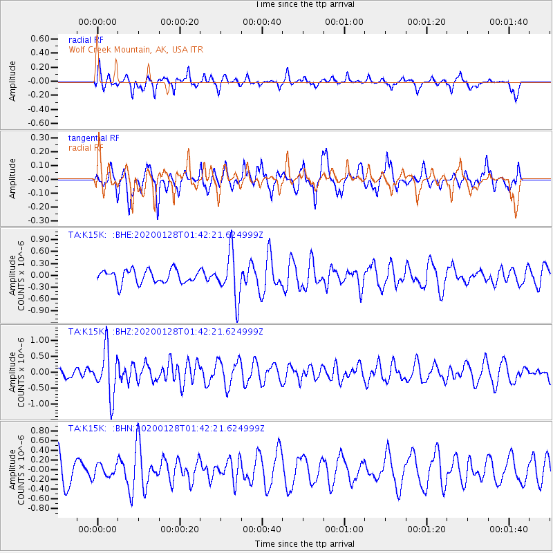
K15K Wolf Creek Mountain, AK, USA - Earthquake Result Viewer
*The percent match for this event was below the threshold and hence no stack was calculated.
| Earthquake location: |
Hokkaido, Japan Region |
| Earthquake latitude/longitude: |
43.6/145.9 |
| Earthquake time(UTC): |
2020/01/28 (028) 01:36:02 GMT |
| Earthquake Depth: |
79 km |
| Earthquake Magnitude: |
5.5 mb |
| Earthquake Catalog/Contributor: |
NEIC PDE/us |
|
| Network: |
TA USArray Transportable Network (new EarthScope stations) |
| Station: |
K15K Wolf Creek Mountain, AK, USA |
| Lat/Lon: |
62.29 N/161.53 W |
| Elevation: |
346 m |
|
| Distance: |
35.5 deg |
| Az: |
39.659 deg |
| Baz: |
263.069 deg |
| Ray Param: |
$rayparam |
*The percent match for this event was below the threshold and hence was not used in the summary stack. |
|
| Radial Match: |
51.33833 % |
| Radial Bump: |
305 |
| Transverse Match: |
48.48797 % |
| Transverse Bump: |
387 |
| SOD ConfigId: |
20465011 |
| Insert Time: |
2020-02-11 01:52:27.442 +0000 |
| GWidth: |
2.5 |
| Max Bumps: |
400 |
| Tol: |
0.001 |
|
Signal To Noise
| Channel | StoN | STA | LTA |
| TA:K15K: :BHZ:20200128T01:42:21.624999Z | 4.709162 | 7.6307305E-7 | 1.620401E-7 |
| TA:K15K: :BHN:20200128T01:42:21.624999Z | 0.3718399 | 1.1918816E-7 | 3.205362E-7 |
| TA:K15K: :BHE:20200128T01:42:21.624999Z | 3.6340399 | 6.0427976E-7 | 1.662832E-7 |
| Arrivals |
| Ps | |
| PpPs | |
| PsPs/PpSs | |


