You are here: Home > Network List > TS - TERRAscope (Southern California Seismic Network) Stations List
> Station PFO Pinon Flat, California, USA > Earthquake Result Viewer
PFO Pinon Flat, California, USA - Earthquake Result Viewer

| Earthquake location: |
Costa Rica |
| Earthquake latitude/longitude: |
9.7/-83.1 |
| Earthquake time(UTC): |
1991/04/22 (112) 21:56:51 GMT |
| Earthquake Depth: |
10 km |
| Earthquake Magnitude: |
6.6 MB, 7.5 MS, 7.4 UNKNOWN |
| Earthquake Catalog/Contributor: |
WHDF/NEIC |
|
| Network: |
TS TERRAscope (Southern California Seismic Network) |
| Station: |
PFO Pinon Flat, California, USA |
| Lat/Lon: |
33.61 N/116.46 W |
| Elevation: |
1280 m |
|
| Distance: |
38.8 deg |
| Az: |
312.916 deg |
| Baz: |
120.091 deg |
| Ray Param: |
0.07534241 |
| Estimated Moho Depth: |
20.0 km |
| Estimated Crust Vp/Vs: |
1.80 |
| Assumed Crust Vp: |
6.264 km/s |
| Estimated Crust Vs: |
3.489 km/s |
| Estimated Crust Poisson's Ratio: |
0.27 |
|
| Radial Match: |
95.877205 % |
| Radial Bump: |
251 |
| Transverse Match: |
91.70706 % |
| Transverse Bump: |
400 |
| SOD ConfigId: |
16938 |
| Insert Time: |
2010-02-26 14:41:27.099 +0000 |
| GWidth: |
2.5 |
| Max Bumps: |
400 |
| Tol: |
0.001 |
|
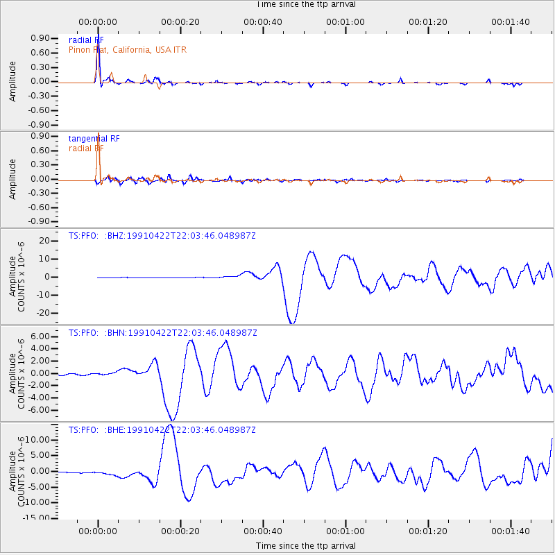
Signal To Noise
| Channel | StoN | STA | LTA |
| TS:PFO: :BHN:19910422T22:03:46.048987Z | 2.0589788 | 2.3758263E-7 | 1.15388566E-7 |
| TS:PFO: :BHE:19910422T22:03:46.048987Z | 5.5154104 | 6.756426E-7 | 1.2250086E-7 |
| TS:PFO: :BHZ:19910422T22:03:46.048987Z | 7.283427 | 8.7390913E-7 | 1.1998598E-7 |
| Arrivals |
| Ps | 2.7 SECOND |
| PpPs | 8.3 SECOND |
| PsPs/PpSs | 11 SECOND |


