You are here: Home > Network List > IW - Intermountain West Stations List
> Station IMW Indian Meadow, Wyoming, USA > Earthquake Result Viewer
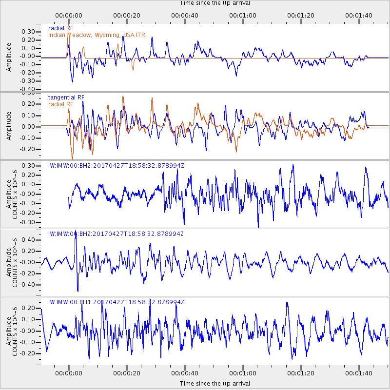
IMW Indian Meadow, Wyoming, USA - Earthquake Result Viewer
*The percent match for this event was below the threshold and hence no stack was calculated.
| Earthquake location: |
Tonga Islands |
| Earthquake latitude/longitude: |
-16.5/-173.7 |
| Earthquake time(UTC): |
2017/04/27 (117) 18:46:42 GMT |
| Earthquake Depth: |
33 km |
| Earthquake Magnitude: |
5.5 mb |
| Earthquake Catalog/Contributor: |
NEIC PDE/us |
|
| Network: |
IW Intermountain West |
| Station: |
IMW Indian Meadow, Wyoming, USA |
| Lat/Lon: |
43.90 N/110.94 W |
| Elevation: |
2646 m |
|
| Distance: |
83.0 deg |
| Az: |
40.35 deg |
| Baz: |
239.223 deg |
| Ray Param: |
$rayparam |
*The percent match for this event was below the threshold and hence was not used in the summary stack. |
|
| Radial Match: |
58.017445 % |
| Radial Bump: |
400 |
| Transverse Match: |
59.81667 % |
| Transverse Bump: |
400 |
| SOD ConfigId: |
2028011 |
| Insert Time: |
2017-05-11 18:53:30.982 +0000 |
| GWidth: |
2.5 |
| Max Bumps: |
400 |
| Tol: |
0.001 |
|
Signal To Noise
| Channel | StoN | STA | LTA |
| IW:IMW:00:BHZ:20170427T18:58:32.878994Z | 4.0608497 | 2.2476036E-7 | 5.5348114E-8 |
| IW:IMW:00:BH1:20170427T18:58:32.878994Z | 0.9116505 | 8.0195136E-8 | 8.7966974E-8 |
| IW:IMW:00:BH2:20170427T18:58:32.878994Z | 1.7207011 | 9.7006534E-8 | 5.6376166E-8 |
| Arrivals |
| Ps | |
| PpPs | |
| PsPs/PpSs | |


