You are here: Home > Network List > IW - Intermountain West Stations List
> Station MOOW Moose Ponds, Wyoming, USA > Earthquake Result Viewer
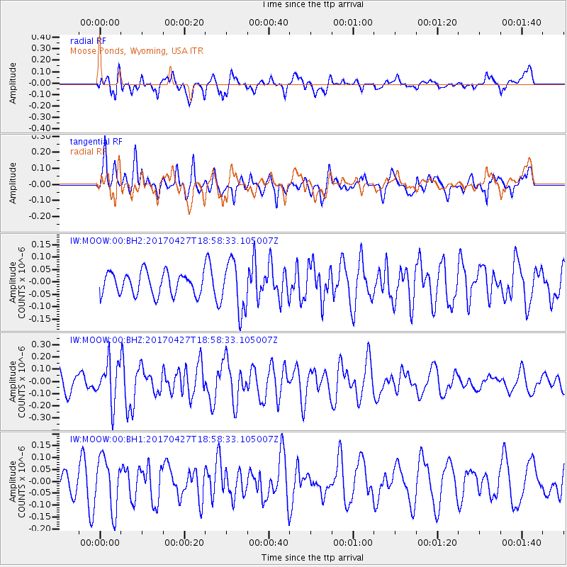
MOOW Moose Ponds, Wyoming, USA - Earthquake Result Viewer
*The percent match for this event was below the threshold and hence no stack was calculated.
| Earthquake location: |
Tonga Islands |
| Earthquake latitude/longitude: |
-16.5/-173.7 |
| Earthquake time(UTC): |
2017/04/27 (117) 18:46:42 GMT |
| Earthquake Depth: |
33 km |
| Earthquake Magnitude: |
5.5 mb |
| Earthquake Catalog/Contributor: |
NEIC PDE/us |
|
| Network: |
IW Intermountain West |
| Station: |
MOOW Moose Ponds, Wyoming, USA |
| Lat/Lon: |
43.75 N/110.74 W |
| Elevation: |
2128 m |
|
| Distance: |
83.0 deg |
| Az: |
40.551 deg |
| Baz: |
239.381 deg |
| Ray Param: |
$rayparam |
*The percent match for this event was below the threshold and hence was not used in the summary stack. |
|
| Radial Match: |
58.43252 % |
| Radial Bump: |
400 |
| Transverse Match: |
62.51153 % |
| Transverse Bump: |
400 |
| SOD ConfigId: |
2028011 |
| Insert Time: |
2017-05-11 18:53:34.378 +0000 |
| GWidth: |
2.5 |
| Max Bumps: |
400 |
| Tol: |
0.001 |
|
Signal To Noise
| Channel | StoN | STA | LTA |
| IW:MOOW:00:BHZ:20170427T18:58:33.105007Z | 1.8400898 | 1.7128157E-7 | 9.3083266E-8 |
| IW:MOOW:00:BH1:20170427T18:58:33.105007Z | 2.0780387 | 1.10499904E-7 | 5.3175093E-8 |
| IW:MOOW:00:BH2:20170427T18:58:33.105007Z | 2.2936177 | 1.0178142E-7 | 4.4375927E-8 |
| Arrivals |
| Ps | |
| PpPs | |
| PsPs/PpSs | |


