You are here: Home > Network List > TS - TERRAscope (Southern California Seismic Network) Stations List
> Station PFO Pinon Flat, California, USA > Earthquake Result Viewer
PFO Pinon Flat, California, USA - Earthquake Result Viewer

| Earthquake location: |
Hokkaido, Japan Region |
| Earthquake latitude/longitude: |
42.0/142.6 |
| Earthquake time(UTC): |
1991/11/26 (330) 19:40:48 GMT |
| Earthquake Depth: |
55 km |
| Earthquake Magnitude: |
6.2 MB |
| Earthquake Catalog/Contributor: |
WHDF/NEIC |
|
| Network: |
TS TERRAscope (Southern California Seismic Network) |
| Station: |
PFO Pinon Flat, California, USA |
| Lat/Lon: |
33.61 N/116.46 W |
| Elevation: |
1280 m |
|
| Distance: |
75.6 deg |
| Az: |
57.763 deg |
| Baz: |
310.953 deg |
| Ray Param: |
0.051459186 |
| Estimated Moho Depth: |
29.0 km |
| Estimated Crust Vp/Vs: |
1.72 |
| Assumed Crust Vp: |
6.264 km/s |
| Estimated Crust Vs: |
3.642 km/s |
| Estimated Crust Poisson's Ratio: |
0.24 |
|
| Radial Match: |
82.32616 % |
| Radial Bump: |
400 |
| Transverse Match: |
64.299736 % |
| Transverse Bump: |
384 |
| SOD ConfigId: |
16938 |
| Insert Time: |
2010-02-26 14:41:31.160 +0000 |
| GWidth: |
2.5 |
| Max Bumps: |
400 |
| Tol: |
0.001 |
|
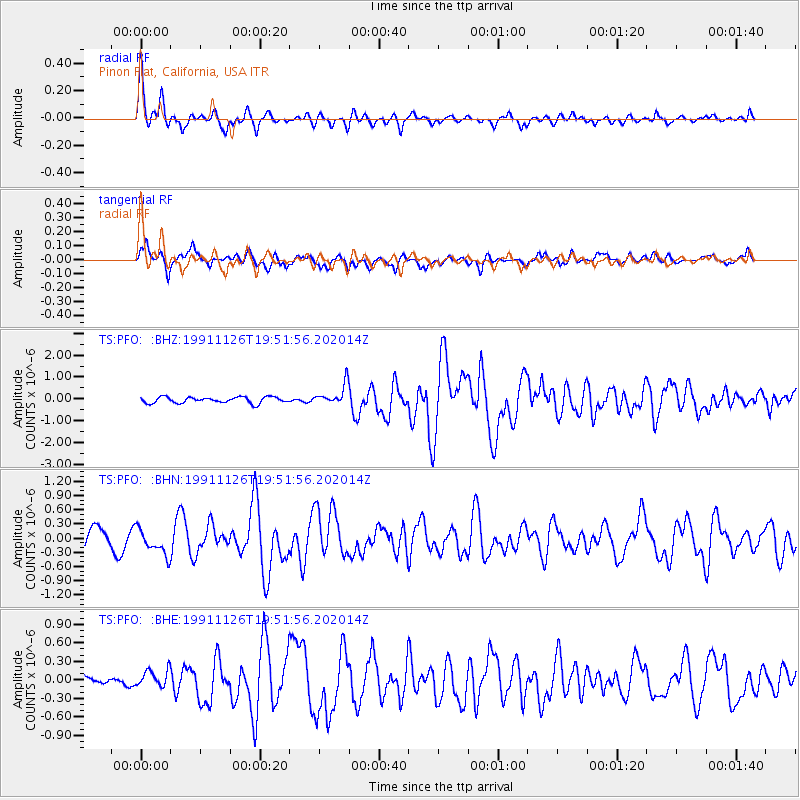
Signal To Noise
| Channel | StoN | STA | LTA |
| TS:PFO: :BHN:19911126T19:51:56.202014Z | 1.6751105 | 2.7109604E-7 | 1.6183772E-7 |
| TS:PFO: :BHE:19911126T19:51:56.202014Z | 0.99174225 | 1.397849E-7 | 1.4094883E-7 |
| TS:PFO: :BHZ:19911126T19:51:56.202014Z | 3.447539 | 4.7500106E-7 | 1.3777975E-7 |
| Arrivals |
| Ps | 3.4 SECOND |
| PpPs | 12 SECOND |
| PsPs/PpSs | 16 SECOND |


