You are here: Home > Network List > US - United States National Seismic Network Stations List
> Station DGMT Dagmar, Montana, USA > Earthquake Result Viewer
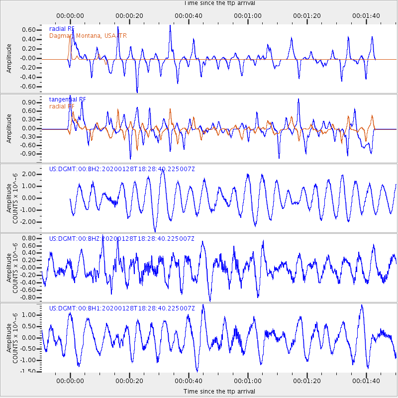
DGMT Dagmar, Montana, USA - Earthquake Result Viewer
*The percent match for this event was below the threshold and hence no stack was calculated.
| Earthquake location: |
Off Coast Of Central Chile |
| Earthquake latitude/longitude: |
-30.3/-72.3 |
| Earthquake time(UTC): |
2020/01/28 (028) 18:16:44 GMT |
| Earthquake Depth: |
10 km |
| Earthquake Magnitude: |
5.5 Mww |
| Earthquake Catalog/Contributor: |
NEIC PDE/us |
|
| Network: |
US United States National Seismic Network |
| Station: |
DGMT Dagmar, Montana, USA |
| Lat/Lon: |
48.47 N/104.20 W |
| Elevation: |
0.0 m |
|
| Distance: |
83.4 deg |
| Az: |
339.297 deg |
| Baz: |
152.639 deg |
| Ray Param: |
$rayparam |
*The percent match for this event was below the threshold and hence was not used in the summary stack. |
|
| Radial Match: |
62.604794 % |
| Radial Bump: |
342 |
| Transverse Match: |
69.64866 % |
| Transverse Bump: |
400 |
| SOD ConfigId: |
20465011 |
| Insert Time: |
2020-02-11 18:31:28.774 +0000 |
| GWidth: |
2.5 |
| Max Bumps: |
400 |
| Tol: |
0.001 |
|
Signal To Noise
| Channel | StoN | STA | LTA |
| US:DGMT:00:BHZ:20200128T18:28:40.225007Z | 0.7594722 | 2.5641128E-7 | 3.3761773E-7 |
| US:DGMT:00:BH1:20200128T18:28:40.225007Z | 1.8790449 | 8.0466197E-7 | 4.2822924E-7 |
| US:DGMT:00:BH2:20200128T18:28:40.225007Z | 2.0185256 | 1.6115343E-6 | 7.98372E-7 |
| Arrivals |
| Ps | |
| PpPs | |
| PsPs/PpSs | |


