You are here: Home > Network List > UU - University of Utah Regional Network Stations List
> Station FORU South Mineral Mountains, UT, USA > Earthquake Result Viewer
FORU South Mineral Mountains, UT, USA - Earthquake Result Viewer
*The percent match for this event was below the threshold and hence no stack was calculated.
| Earthquake location: |
Tonga Islands |
| Earthquake latitude/longitude: |
-16.5/-173.7 |
| Earthquake time(UTC): |
2017/04/27 (117) 18:46:42 GMT |
| Earthquake Depth: |
33 km |
| Earthquake Magnitude: |
5.5 mb |
| Earthquake Catalog/Contributor: |
NEIC PDE/us |
|
| Network: |
UU University of Utah Regional Network |
| Station: |
FORU South Mineral Mountains, UT, USA |
| Lat/Lon: |
38.46 N/112.86 W |
| Elevation: |
1840 m |
|
| Distance: |
78.9 deg |
| Az: |
44.301 deg |
| Baz: |
238.584 deg |
| Ray Param: |
$rayparam |
*The percent match for this event was below the threshold and hence was not used in the summary stack. |
|
| Radial Match: |
39.434242 % |
| Radial Bump: |
348 |
| Transverse Match: |
46.799553 % |
| Transverse Bump: |
297 |
| SOD ConfigId: |
2028011 |
| Insert Time: |
2017-05-11 18:55:04.199 +0000 |
| GWidth: |
2.5 |
| Max Bumps: |
400 |
| Tol: |
0.001 |
|
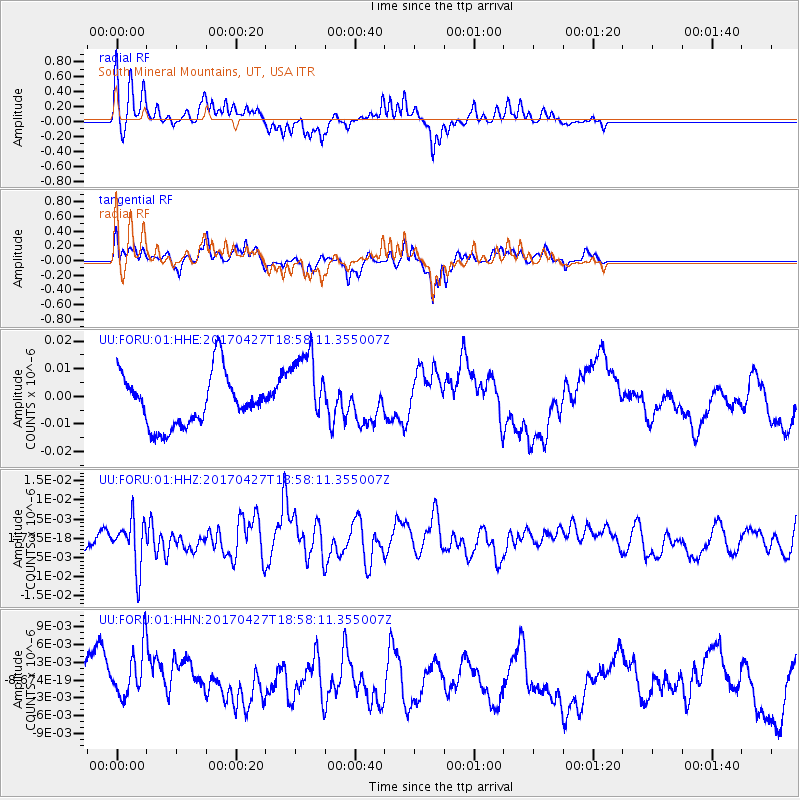
Signal To Noise
| Channel | StoN | STA | LTA |
| UU:FORU:01:HHZ:20170427T18:58:11.355007Z | 1.3284218 | 6.2754832E-9 | 4.7240136E-9 |
| UU:FORU:01:HHN:20170427T18:58:11.355007Z | 1.1540421 | 4.8241002E-9 | 4.1801766E-9 |
| UU:FORU:01:HHE:20170427T18:58:11.355007Z | 1.538834 | 1.4305073E-8 | 9.296047E-9 |
| Arrivals |
| Ps | |
| PpPs | |
| PsPs/PpSs | |


