You are here: Home > Network List > TS - TERRAscope (Southern California Seismic Network) Stations List
> Station PFO Pinon Flat, California, USA > Earthquake Result Viewer
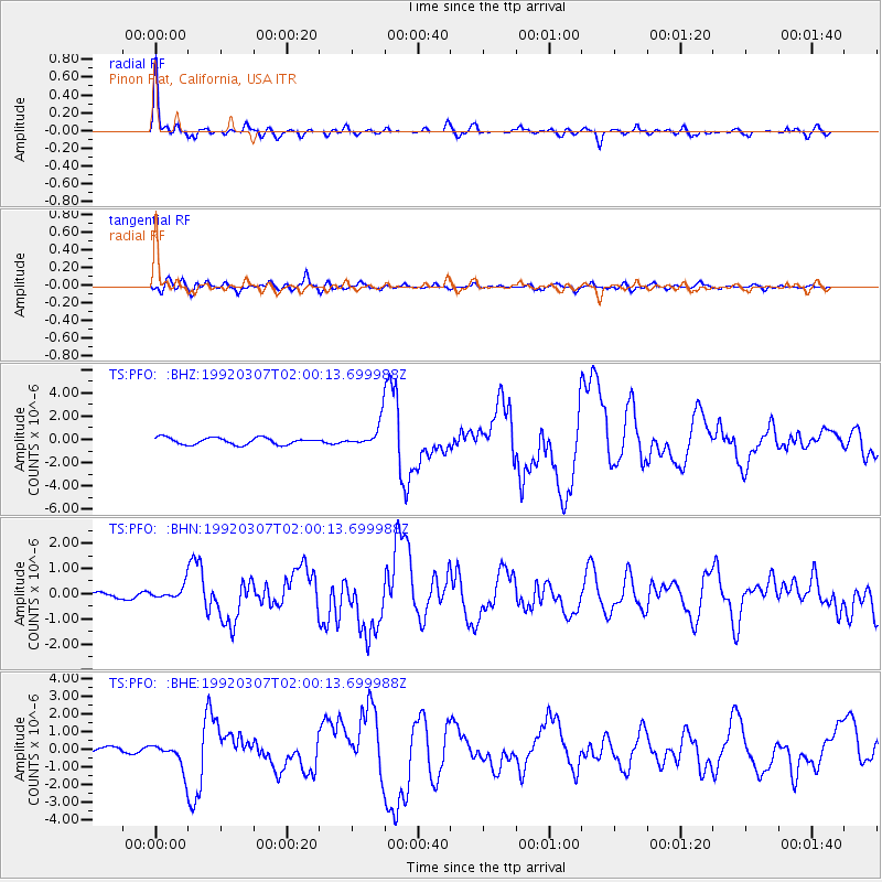
PFO Pinon Flat, California, USA - Earthquake Result Viewer

| Earthquake location: |
Costa Rica |
| Earthquake latitude/longitude: |
10.2/-84.3 |
| Earthquake time(UTC): |
1992/03/07 (067) 01:53:36 GMT |
| Earthquake Depth: |
73 km |
| Earthquake Magnitude: |
6.3 MB, 5.6 UNKNOWN, 5.6 MD |
| Earthquake Catalog/Contributor: |
WHDF/NEIC |
|
| Network: |
TS TERRAscope (Southern California Seismic Network) |
| Station: |
PFO Pinon Flat, California, USA |
| Lat/Lon: |
33.61 N/116.46 W |
| Elevation: |
1280 m |
|
| Distance: |
37.6 deg |
| Az: |
313.295 deg |
| Baz: |
120.849 deg |
| Ray Param: |
0.07584833 |
| Estimated Moho Depth: |
16.75 km |
| Estimated Crust Vp/Vs: |
2.10 |
| Assumed Crust Vp: |
6.264 km/s |
| Estimated Crust Vs: |
2.99 km/s |
| Estimated Crust Poisson's Ratio: |
0.35 |
|
| Radial Match: |
94.553185 % |
| Radial Bump: |
387 |
| Transverse Match: |
80.79393 % |
| Transverse Bump: |
400 |
| SOD ConfigId: |
16938 |
| Insert Time: |
2010-02-26 14:41:38.570 +0000 |
| GWidth: |
2.5 |
| Max Bumps: |
400 |
| Tol: |
0.001 |
|
Signal To Noise
| Channel | StoN | STA | LTA |
| TS:PFO: :BHN:19920307T02:00:13.699988Z | 1.0249944 | 2.4856251E-7 | 2.4250133E-7 |
| TS:PFO: :BHE:19920307T02:00:13.699988Z | 4.100873 | 7.439797E-7 | 1.8141984E-7 |
| TS:PFO: :BHZ:19920307T02:00:13.699988Z | 3.6246681 | 1.0856958E-6 | 2.995297E-7 |
| Arrivals |
| Ps | 3.1 SECOND |
| PpPs | 7.8 SECOND |
| PsPs/PpSs | 11 SECOND |


