You are here: Home > Network List > AZ - ANZA Regional Network Stations List
> Station LVA2 AZ.LVA2 > Earthquake Result Viewer
LVA2 AZ.LVA2 - Earthquake Result Viewer
*The percent match for this event was below the threshold and hence no stack was calculated.
| Earthquake location: |
North Of Honduras |
| Earthquake latitude/longitude: |
18.9/-80.7 |
| Earthquake time(UTC): |
2020/01/28 (028) 21:55:16 GMT |
| Earthquake Depth: |
10 km |
| Earthquake Magnitude: |
6.1 mww |
| Earthquake Catalog/Contributor: |
NEIC PDE/us |
|
| Network: |
AZ ANZA Regional Network |
| Station: |
LVA2 AZ.LVA2 |
| Lat/Lon: |
33.35 N/116.56 W |
| Elevation: |
1435 m |
|
| Distance: |
35.0 deg |
| Az: |
301.38 deg |
| Baz: |
105.113 deg |
| Ray Param: |
$rayparam |
*The percent match for this event was below the threshold and hence was not used in the summary stack. |
|
| Radial Match: |
71.93826 % |
| Radial Bump: |
394 |
| Transverse Match: |
71.08436 % |
| Transverse Bump: |
400 |
| SOD ConfigId: |
20465011 |
| Insert Time: |
2020-02-11 21:58:31.159 +0000 |
| GWidth: |
2.5 |
| Max Bumps: |
400 |
| Tol: |
0.001 |
|
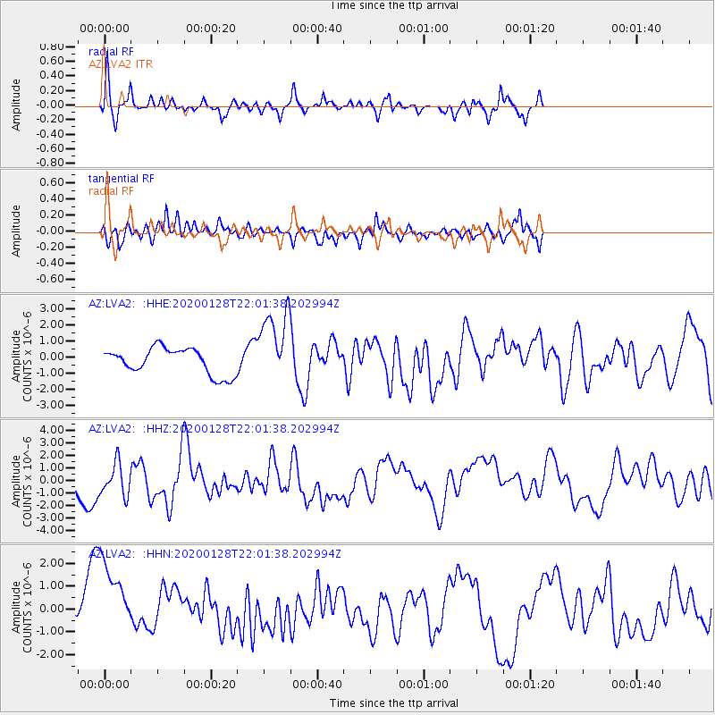
Signal To Noise
| Channel | StoN | STA | LTA |
| AZ:LVA2: :HHZ:20200128T22:01:38.202994Z | 1.1418687 | 1.2806581E-6 | 1.1215459E-6 |
| AZ:LVA2: :HHN:20200128T22:01:38.202994Z | 2.9774973 | 2.232162E-6 | 7.4967716E-7 |
| AZ:LVA2: :HHE:20200128T22:01:38.202994Z | 2.813793 | 2.2768056E-6 | 8.091589E-7 |
| Arrivals |
| Ps | |
| PpPs | |
| PsPs/PpSs | |


