You are here: Home > Network List > CN - Canadian National Seismograph Network Stations List
> Station INK INUVIK, NT > Earthquake Result Viewer
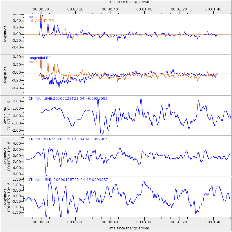
INK INUVIK, NT - Earthquake Result Viewer
*The percent match for this event was below the threshold and hence no stack was calculated.
| Earthquake location: |
North Of Honduras |
| Earthquake latitude/longitude: |
18.9/-80.7 |
| Earthquake time(UTC): |
2020/01/28 (028) 21:55:16 GMT |
| Earthquake Depth: |
10 km |
| Earthquake Magnitude: |
6.1 mww |
| Earthquake Catalog/Contributor: |
NEIC PDE/us |
|
| Network: |
CN Canadian National Seismograph Network |
| Station: |
INK INUVIK, NT |
| Lat/Lon: |
68.31 N/133.53 W |
| Elevation: |
44 m |
|
| Distance: |
59.2 deg |
| Az: |
339.826 deg |
| Baz: |
118.6 deg |
| Ray Param: |
$rayparam |
*The percent match for this event was below the threshold and hence was not used in the summary stack. |
|
| Radial Match: |
75.09437 % |
| Radial Bump: |
297 |
| Transverse Match: |
64.377945 % |
| Transverse Bump: |
400 |
| SOD ConfigId: |
20465011 |
| Insert Time: |
2020-02-11 22:02:33.231 +0000 |
| GWidth: |
2.5 |
| Max Bumps: |
400 |
| Tol: |
0.001 |
|
Signal To Noise
| Channel | StoN | STA | LTA |
| CN:INK: :BHZ:20200128T22:04:46.099998Z | 3.3490317 | 2.7774895E-6 | 8.293411E-7 |
| CN:INK: :BHN:20200128T22:04:46.099998Z | 2.5353966 | 1.6093163E-6 | 6.3473954E-7 |
| CN:INK: :BHE:20200128T22:04:46.099998Z | 1.5746467 | 1.1996702E-6 | 7.618663E-7 |
| Arrivals |
| Ps | |
| PpPs | |
| PsPs/PpSs | |


