You are here: Home > Network List > IW - Intermountain West Stations List
> Station MOOW Moose Ponds, Wyoming, USA > Earthquake Result Viewer
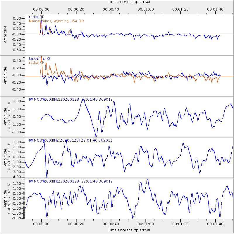
MOOW Moose Ponds, Wyoming, USA - Earthquake Result Viewer
*The percent match for this event was below the threshold and hence no stack was calculated.
| Earthquake location: |
North Of Honduras |
| Earthquake latitude/longitude: |
18.9/-80.7 |
| Earthquake time(UTC): |
2020/01/28 (028) 21:55:16 GMT |
| Earthquake Depth: |
10 km |
| Earthquake Magnitude: |
6.1 mww |
| Earthquake Catalog/Contributor: |
NEIC PDE/us |
|
| Network: |
IW Intermountain West |
| Station: |
MOOW Moose Ponds, Wyoming, USA |
| Lat/Lon: |
43.75 N/110.74 W |
| Elevation: |
2128 m |
|
| Distance: |
35.3 deg |
| Az: |
321.115 deg |
| Baz: |
124.926 deg |
| Ray Param: |
$rayparam |
*The percent match for this event was below the threshold and hence was not used in the summary stack. |
|
| Radial Match: |
72.82346 % |
| Radial Bump: |
400 |
| Transverse Match: |
39.061966 % |
| Transverse Bump: |
400 |
| SOD ConfigId: |
20465011 |
| Insert Time: |
2020-02-11 22:04:47.696 +0000 |
| GWidth: |
2.5 |
| Max Bumps: |
400 |
| Tol: |
0.001 |
|
Signal To Noise
| Channel | StoN | STA | LTA |
| IW:MOOW:00:BHZ:20200128T22:01:40.36901Z | 2.335486 | 2.2906015E-6 | 9.807816E-7 |
| IW:MOOW:00:BH1:20200128T22:01:40.36901Z | 1.650693 | 7.947041E-7 | 4.814366E-7 |
| IW:MOOW:00:BH2:20200128T22:01:40.36901Z | 2.0733728 | 1.5699184E-6 | 7.571809E-7 |
| Arrivals |
| Ps | |
| PpPs | |
| PsPs/PpSs | |


