You are here: Home > Network List > TA - USArray Transportable Network (new EarthScope stations) Stations List
> Station F20K Avaraart Lake, AK, USA > Earthquake Result Viewer
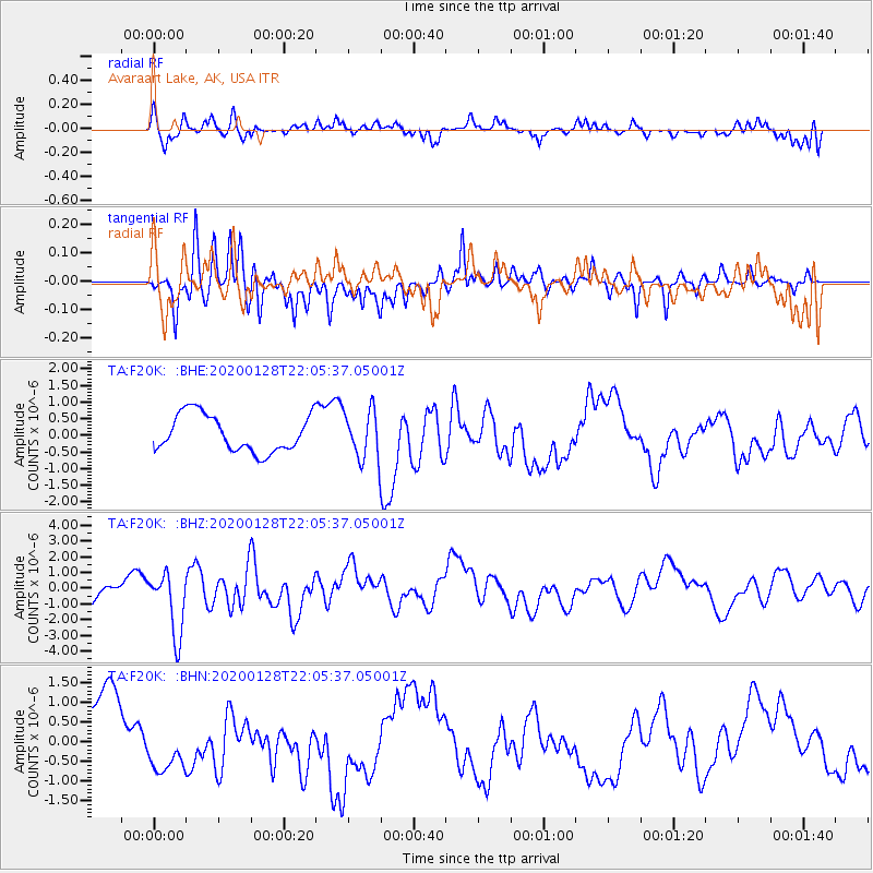
F20K Avaraart Lake, AK, USA - Earthquake Result Viewer
*The percent match for this event was below the threshold and hence no stack was calculated.
| Earthquake location: |
North Of Honduras |
| Earthquake latitude/longitude: |
18.9/-80.7 |
| Earthquake time(UTC): |
2020/01/28 (028) 21:55:16 GMT |
| Earthquake Depth: |
10 km |
| Earthquake Magnitude: |
6.1 mww |
| Earthquake Catalog/Contributor: |
NEIC PDE/us |
|
| Network: |
TA USArray Transportable Network (new EarthScope stations) |
| Station: |
F20K Avaraart Lake, AK, USA |
| Lat/Lon: |
67.05 N/155.73 W |
| Elevation: |
136 m |
|
| Distance: |
66.9 deg |
| Az: |
335.672 deg |
| Baz: |
96.156 deg |
| Ray Param: |
$rayparam |
*The percent match for this event was below the threshold and hence was not used in the summary stack. |
|
| Radial Match: |
61.40727 % |
| Radial Bump: |
400 |
| Transverse Match: |
46.04511 % |
| Transverse Bump: |
397 |
| SOD ConfigId: |
20465011 |
| Insert Time: |
2020-02-11 22:07:46.867 +0000 |
| GWidth: |
2.5 |
| Max Bumps: |
400 |
| Tol: |
0.001 |
|
Signal To Noise
| Channel | StoN | STA | LTA |
| TA:F20K: :BHZ:20200128T22:05:37.05001Z | 2.6565087 | 2.0292166E-6 | 7.6386596E-7 |
| TA:F20K: :BHN:20200128T22:05:37.05001Z | 0.97764343 | 7.0155096E-7 | 7.175939E-7 |
| TA:F20K: :BHE:20200128T22:05:37.05001Z | 1.3084271 | 7.261874E-7 | 5.5500794E-7 |
| Arrivals |
| Ps | |
| PpPs | |
| PsPs/PpSs | |


