You are here: Home > Network List > TA - USArray Transportable Network (new EarthScope stations) Stations List
> Station G31M Satah River, YT, CAN > Earthquake Result Viewer
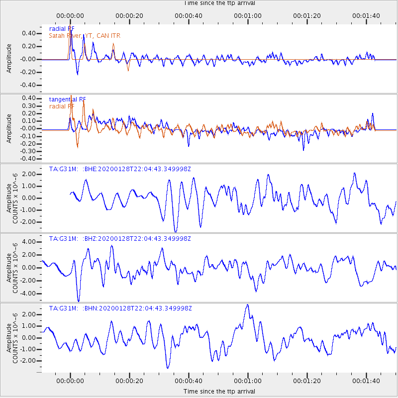
G31M Satah River, YT, CAN - Earthquake Result Viewer
*The percent match for this event was below the threshold and hence no stack was calculated.
| Earthquake location: |
North Of Honduras |
| Earthquake latitude/longitude: |
18.9/-80.7 |
| Earthquake time(UTC): |
2020/01/28 (028) 21:55:16 GMT |
| Earthquake Depth: |
10 km |
| Earthquake Magnitude: |
6.1 mww |
| Earthquake Catalog/Contributor: |
NEIC PDE/us |
|
| Network: |
TA USArray Transportable Network (new EarthScope stations) |
| Station: |
G31M Satah River, YT, CAN |
| Lat/Lon: |
66.92 N/134.27 W |
| Elevation: |
61 m |
|
| Distance: |
58.8 deg |
| Az: |
338.236 deg |
| Baz: |
117.092 deg |
| Ray Param: |
$rayparam |
*The percent match for this event was below the threshold and hence was not used in the summary stack. |
|
| Radial Match: |
56.524624 % |
| Radial Bump: |
400 |
| Transverse Match: |
60.115932 % |
| Transverse Bump: |
400 |
| SOD ConfigId: |
20465011 |
| Insert Time: |
2020-02-11 22:07:58.683 +0000 |
| GWidth: |
2.5 |
| Max Bumps: |
400 |
| Tol: |
0.001 |
|
Signal To Noise
| Channel | StoN | STA | LTA |
| TA:G31M: :BHZ:20200128T22:04:43.349998Z | 2.479655 | 2.264597E-6 | 9.1327104E-7 |
| TA:G31M: :BHN:20200128T22:04:43.349998Z | 1.7127082 | 1.3607993E-6 | 7.945307E-7 |
| TA:G31M: :BHE:20200128T22:04:43.349998Z | 2.0544472 | 1.128286E-6 | 5.4919207E-7 |
| Arrivals |
| Ps | |
| PpPs | |
| PsPs/PpSs | |


