You are here: Home > Network List > GS - US Geological Survey Networks Stations List
> Station DEC05 Decatur Surface Seismic Site, Decatur, IL, USA > Earthquake Result Viewer
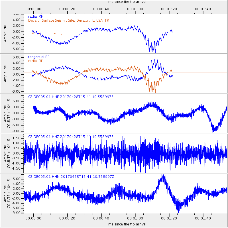
DEC05 Decatur Surface Seismic Site, Decatur, IL, USA - Earthquake Result Viewer
*The percent match for this event was below the threshold and hence no stack was calculated.
| Earthquake location: |
Near Coast Of Central Chile |
| Earthquake latitude/longitude: |
-33.2/-72.0 |
| Earthquake time(UTC): |
2017/04/28 (118) 15:30:05 GMT |
| Earthquake Depth: |
20 km |
| Earthquake Magnitude: |
5.9 Mww |
| Earthquake Catalog/Contributor: |
NEIC PDE/us |
|
| Network: |
GS US Geological Survey Networks |
| Station: |
DEC05 Decatur Surface Seismic Site, Decatur, IL, USA |
| Lat/Lon: |
39.87 N/88.87 W |
| Elevation: |
216 m |
|
| Distance: |
74.4 deg |
| Az: |
346.593 deg |
| Baz: |
165.376 deg |
| Ray Param: |
$rayparam |
*The percent match for this event was below the threshold and hence was not used in the summary stack. |
|
| Radial Match: |
66.727135 % |
| Radial Bump: |
400 |
| Transverse Match: |
62.87851 % |
| Transverse Bump: |
400 |
| SOD ConfigId: |
2028011 |
| Insert Time: |
2017-05-12 15:33:42.815 +0000 |
| GWidth: |
2.5 |
| Max Bumps: |
400 |
| Tol: |
0.001 |
|
Signal To Noise
| Channel | StoN | STA | LTA |
| GS:DEC05:01:HHZ:20170428T15:41:10.558997Z | 1.3347738 | 5.925011E-7 | 4.4389628E-7 |
| GS:DEC05:01:HHN:20170428T15:41:10.558997Z | 1.0098926 | 1.0907831E-6 | 1.0800982E-6 |
| GS:DEC05:01:HHE:20170428T15:41:10.558997Z | 0.43111882 | 6.347562E-7 | 1.4723463E-6 |
| Arrivals |
| Ps | |
| PpPs | |
| PsPs/PpSs | |


