You are here: Home > Network List > TA - USArray Transportable Network (new EarthScope stations) Stations List
> Station K15K Wolf Creek Mountain, AK, USA > Earthquake Result Viewer
K15K Wolf Creek Mountain, AK, USA - Earthquake Result Viewer

| Earthquake location: |
North Of Honduras |
| Earthquake latitude/longitude: |
18.9/-80.7 |
| Earthquake time(UTC): |
2020/01/28 (028) 21:55:16 GMT |
| Earthquake Depth: |
10 km |
| Earthquake Magnitude: |
6.1 mww |
| Earthquake Catalog/Contributor: |
NEIC PDE/us |
|
| Network: |
TA USArray Transportable Network (new EarthScope stations) |
| Station: |
K15K Wolf Creek Mountain, AK, USA |
| Lat/Lon: |
62.29 N/161.53 W |
| Elevation: |
346 m |
|
| Distance: |
69.2 deg |
| Az: |
330.414 deg |
| Baz: |
88.939 deg |
| Ray Param: |
0.055838652 |
| Estimated Moho Depth: |
56.25 km |
| Estimated Crust Vp/Vs: |
1.85 |
| Assumed Crust Vp: |
6.276 km/s |
| Estimated Crust Vs: |
3.402 km/s |
| Estimated Crust Poisson's Ratio: |
0.29 |
|
| Radial Match: |
89.26393 % |
| Radial Bump: |
400 |
| Transverse Match: |
60.375668 % |
| Transverse Bump: |
299 |
| SOD ConfigId: |
20465011 |
| Insert Time: |
2020-02-11 22:08:21.780 +0000 |
| GWidth: |
2.5 |
| Max Bumps: |
400 |
| Tol: |
0.001 |
|
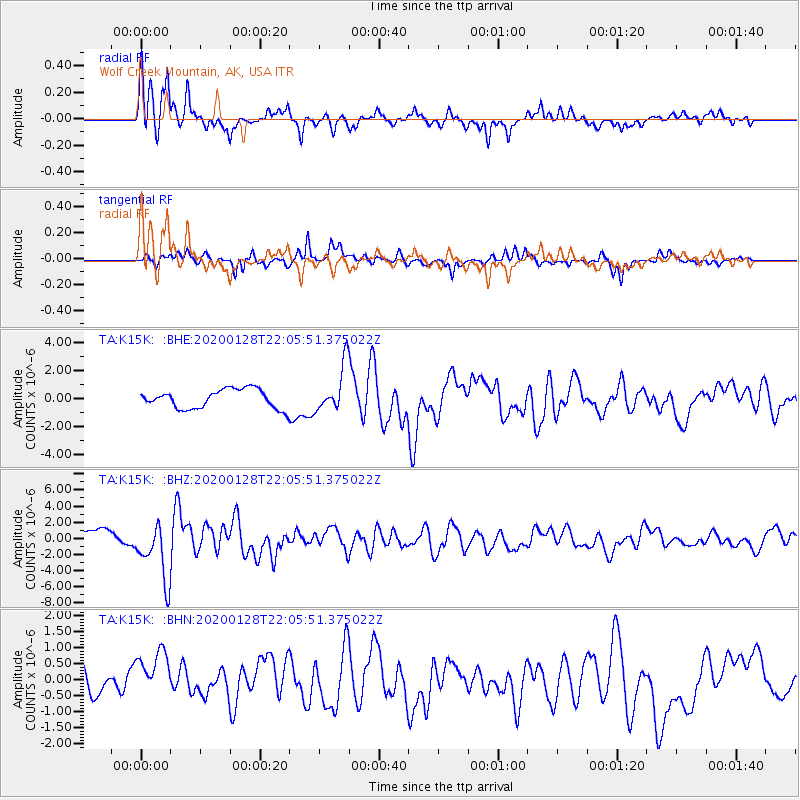
Signal To Noise
| Channel | StoN | STA | LTA |
| TA:K15K: :BHZ:20200128T22:05:51.375022Z | 4.3405037 | 3.6353117E-6 | 8.3753224E-7 |
| TA:K15K: :BHN:20200128T22:05:51.375022Z | 1.2434541 | 9.336234E-7 | 7.508306E-7 |
| TA:K15K: :BHE:20200128T22:05:51.375022Z | 2.4802718 | 1.670561E-6 | 6.7353943E-7 |
| Arrivals |
| Ps | 7.8 SECOND |
| PpPs | 25 SECOND |
| PsPs/PpSs | 32 SECOND |


