VSL Villasalto, Italy - Earthquake Result Viewer
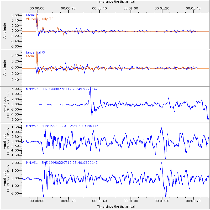
Earthquake location: Afghanistan-Tajikistan Bord Reg.
Earthquake latitude/longitude: 36.5/71.1
Earthquake time(UTC): 1998/02/20 (051) 12:18:06 GMT
Earthquake Depth: 236 km
Earthquake Magnitude: 5.8 MB, 5.7 MS, 6.4 UNKNOWN, 6.3 MW
Earthquake Catalog/Contributor: WHDF/NEIC
Network: MN MEDNET Project
Station: VSL Villasalto, Italy
Lat/Lon: 39.50 N/9.38 E
Elevation: 370 m
Distance: 47.9 deg
Az: 293.304 deg
Baz: 73.07 deg
Ray Param: 0.06879612
Estimated Moho Depth: 67.0 km
Estimated Crust Vp/Vs: 1.72
Assumed Crust Vp: 6.183 km/s
Estimated Crust Vs: 3.6 km/s
Estimated Crust Poisson's Ratio: 0.24
Radial Match: 92.256294 %
Radial Bump: 394
Transverse Match: 80.88065 %
Transverse Bump: 400
SOD ConfigId: 6273
Insert Time: 2010-03-08 17:46:28.349 +0000
GWidth: 2.5
Max Bumps: 400
Tol: 0.001

Signal To Noise

ChannelStoNSTALTA
MN:VSL: :BHN:19980220T12:25:49.939014Z7.3561355.167941E-77.0253485E-8
MN:VSL: :BHE:19980220T12:25:49.939014Z12.67698.5307715E-76.729383E-8
MN:VSL: :BHZ:19980220T12:25:49.939014Z21.0350822.4196995E-61.1503162E-7
Arrivals
Ps8.2 SECOND
PpPs28 SECOND
PsPs/PpSs36 SECOND