You are here: Home > Network List > UU - University of Utah Regional Network Stations List
> Station FORU South Mineral Mountains, UT, USA > Earthquake Result Viewer
FORU South Mineral Mountains, UT, USA - Earthquake Result Viewer
*The percent match for this event was below the threshold and hence no stack was calculated.
| Earthquake location: |
Near Coast Of Peru |
| Earthquake latitude/longitude: |
-10.4/-78.6 |
| Earthquake time(UTC): |
2020/01/15 (015) 09:45:18 GMT |
| Earthquake Depth: |
38 km |
| Earthquake Magnitude: |
5.4 Mww |
| Earthquake Catalog/Contributor: |
NEIC PDE/us |
|
| Network: |
UU University of Utah Regional Network |
| Station: |
FORU South Mineral Mountains, UT, USA |
| Lat/Lon: |
38.46 N/112.86 W |
| Elevation: |
1840 m |
|
| Distance: |
58.2 deg |
| Az: |
328.645 deg |
| Baz: |
139.3 deg |
| Ray Param: |
$rayparam |
*The percent match for this event was below the threshold and hence was not used in the summary stack. |
|
| Radial Match: |
49.76071 % |
| Radial Bump: |
400 |
| Transverse Match: |
56.758724 % |
| Transverse Bump: |
400 |
| SOD ConfigId: |
20465011 |
| Insert Time: |
2020-02-12 09:33:07.877 +0000 |
| GWidth: |
2.5 |
| Max Bumps: |
400 |
| Tol: |
0.001 |
|
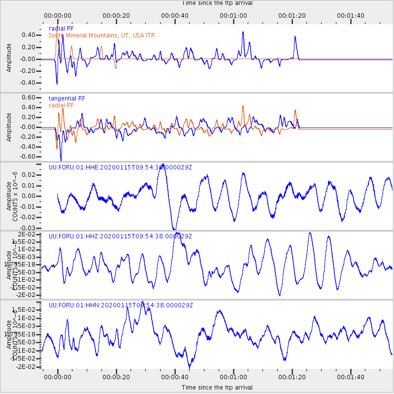
Signal To Noise
| Channel | StoN | STA | LTA |
| UU:FORU:01:HHZ:20200115T09:54:38.000029Z | 0.9363209 | 6.3316175E-9 | 6.76223E-9 |
| UU:FORU:01:HHN:20200115T09:54:38.000029Z | 1.1125219 | 8.037394E-9 | 7.2244815E-9 |
| UU:FORU:01:HHE:20200115T09:54:38.000029Z | 2.3145623 | 1.4149471E-8 | 6.1132384E-9 |
| Arrivals |
| Ps | |
| PpPs | |
| PsPs/PpSs | |


