You are here: Home > Network List > US - United States National Seismic Network Stations List
> Station AGMN Agassiz National Wildlife Refuge, Minnesota, USA > Earthquake Result Viewer
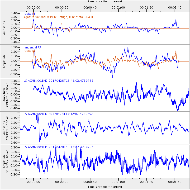
AGMN Agassiz National Wildlife Refuge, Minnesota, USA - Earthquake Result Viewer
*The percent match for this event was below the threshold and hence no stack was calculated.
| Earthquake location: |
Near Coast Of Central Chile |
| Earthquake latitude/longitude: |
-33.2/-72.0 |
| Earthquake time(UTC): |
2017/04/28 (118) 15:30:05 GMT |
| Earthquake Depth: |
20 km |
| Earthquake Magnitude: |
5.9 Mww |
| Earthquake Catalog/Contributor: |
NEIC PDE/us |
|
| Network: |
US United States National Seismic Network |
| Station: |
AGMN Agassiz National Wildlife Refuge, Minnesota, USA |
| Lat/Lon: |
48.30 N/95.86 W |
| Elevation: |
351 m |
|
| Distance: |
83.9 deg |
| Az: |
344.236 deg |
| Baz: |
160.066 deg |
| Ray Param: |
$rayparam |
*The percent match for this event was below the threshold and hence was not used in the summary stack. |
|
| Radial Match: |
48.347416 % |
| Radial Bump: |
400 |
| Transverse Match: |
49.05452 % |
| Transverse Bump: |
400 |
| SOD ConfigId: |
2028011 |
| Insert Time: |
2017-05-12 15:38:17.844 +0000 |
| GWidth: |
2.5 |
| Max Bumps: |
400 |
| Tol: |
0.001 |
|
Signal To Noise
| Channel | StoN | STA | LTA |
| US:AGMN:00:BHZ:20170428T15:42:02.473975Z | 4.74539 | 3.1361714E-7 | 6.608881E-8 |
| US:AGMN:00:BH1:20170428T15:42:02.473975Z | 1.6066035 | 8.784553E-8 | 5.4677788E-8 |
| US:AGMN:00:BH2:20170428T15:42:02.473975Z | 2.1791663 | 2.0723151E-7 | 9.509669E-8 |
| Arrivals |
| Ps | |
| PpPs | |
| PsPs/PpSs | |


