You are here: Home > Network List > CI - Caltech Regional Seismic Network Stations List
> Station SMM Simmler, CA, USA > Earthquake Result Viewer
SMM Simmler, CA, USA - Earthquake Result Viewer
*The percent match for this event was below the threshold and hence no stack was calculated.
| Earthquake location: |
Solomon Islands |
| Earthquake latitude/longitude: |
-10.4/161.3 |
| Earthquake time(UTC): |
2020/01/29 (029) 13:49:50 GMT |
| Earthquake Depth: |
87 km |
| Earthquake Magnitude: |
6.0 Mww |
| Earthquake Catalog/Contributor: |
NEIC PDE/us |
|
| Network: |
CI Caltech Regional Seismic Network |
| Station: |
SMM Simmler, CA, USA |
| Lat/Lon: |
35.31 N/120.00 W |
| Elevation: |
599 m |
|
| Distance: |
86.9 deg |
| Az: |
53.439 deg |
| Baz: |
255.083 deg |
| Ray Param: |
$rayparam |
*The percent match for this event was below the threshold and hence was not used in the summary stack. |
|
| Radial Match: |
68.77928 % |
| Radial Bump: |
400 |
| Transverse Match: |
52.190346 % |
| Transverse Bump: |
400 |
| SOD ConfigId: |
20465011 |
| Insert Time: |
2020-02-12 13:56:02.852 +0000 |
| GWidth: |
2.5 |
| Max Bumps: |
400 |
| Tol: |
0.001 |
|
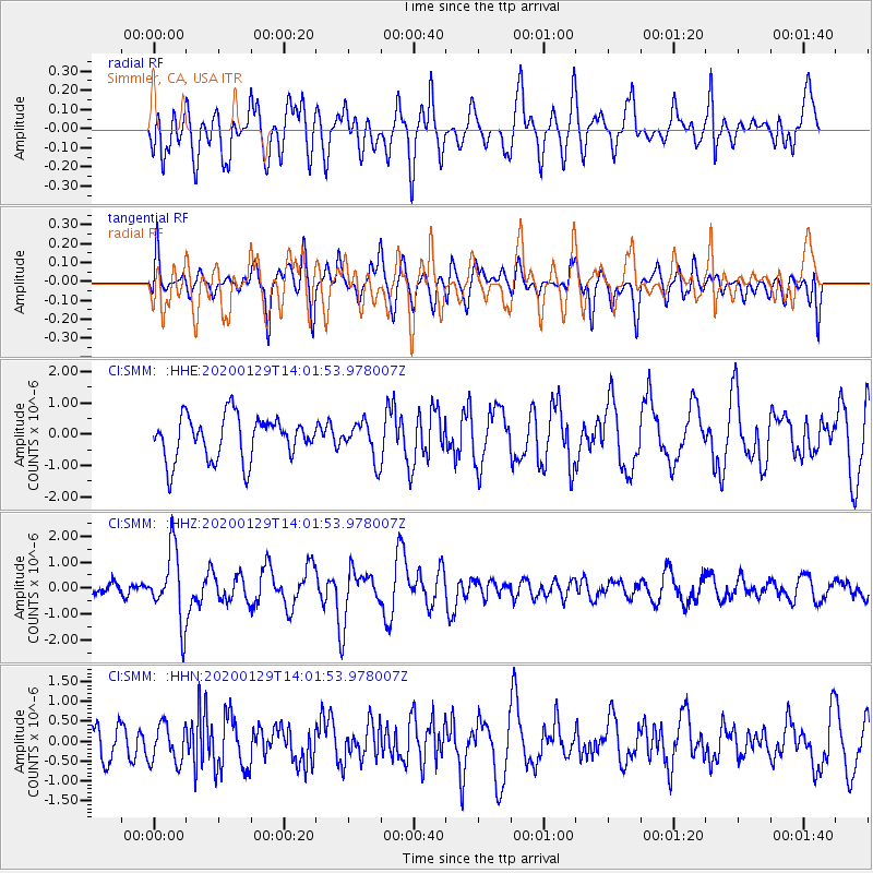
Signal To Noise
| Channel | StoN | STA | LTA |
| CI:SMM: :HHZ:20200129T14:01:53.978007Z | 6.153524 | 1.3667033E-6 | 2.2210091E-7 |
| CI:SMM: :HHN:20200129T14:01:53.978007Z | 0.64549476 | 4.781307E-7 | 7.407197E-7 |
| CI:SMM: :HHE:20200129T14:01:53.978007Z | 0.8555388 | 5.8910643E-7 | 6.8857946E-7 |
| Arrivals |
| Ps | |
| PpPs | |
| PsPs/PpSs | |


